When Matt and I left the CDT at the end of our 600 mile, summer 2015 hike through New Mexico, I still had two sections of the trail remaining. I completed both of them during the spring of 2016. First, Matt and I traveled to New Mexico during our spring break to hike 143 miles from the Mexican border to Silver City, New Mexico. Two weeks later, I returned to New Mexico with my mom and sister to hike sixty additional miles, thus finishing the Continental Divide Trail, and the triple crown of American long distance hiking. Below is a recap of those final two sections in New Mexico, followed by day by day journal entries of the first 2600 miles of my CDT hike.
At the beginning of our early March spring break, Matt and I flew to el Paso, Texas and took a Greyhound bus out to Lourdsburg. The Continental Divide Trail Coalition has arranged shuttles for hikers from Lourdsburg to the Mexican border at the Crazy Cook monument. The monument is at the end of an extremely rough dirt road, and there is otherwise no way for hikers to reach border in this immediate area. The drive from Lourdsburg to the border is eight-five miles and takes three or so hours and is rougher than anything I could have imagined. When Jeff dropped us off at the border, my organs had been thoroughly shaken, and I didn’t envy him for having to turn around and drive back to town.
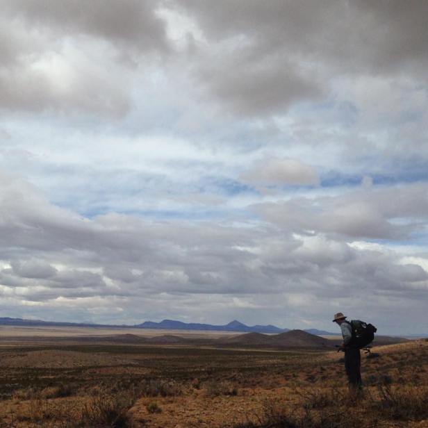
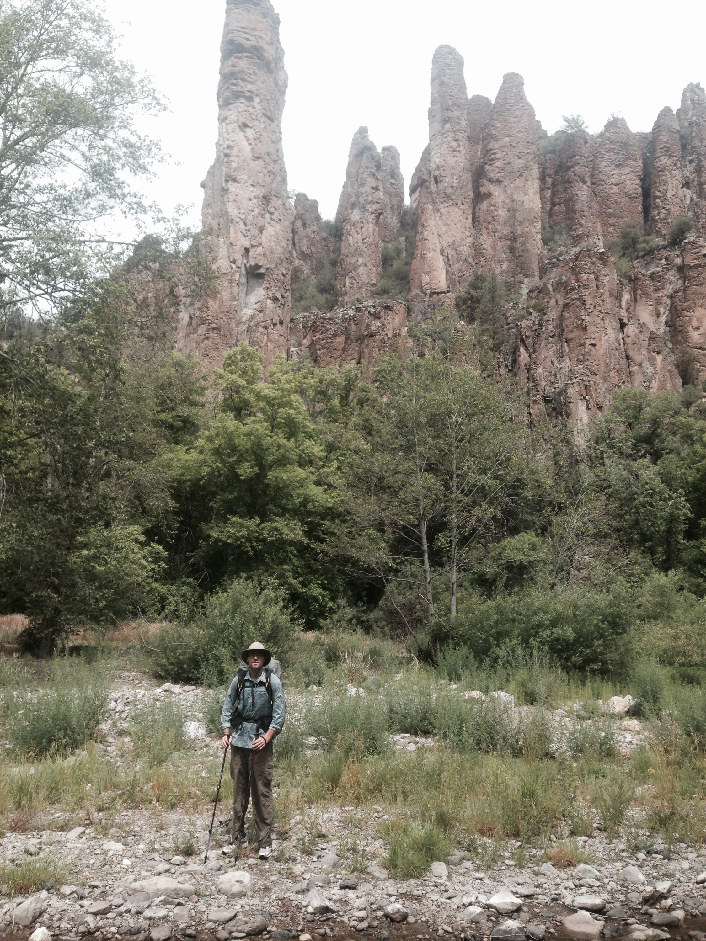
Jeff took a picture of Matt and I at the border monument. We gazed across the broken down barbed wire fence into Mexico and turned north. Jeff drove off, and we were on our own. The first two miles or so of hiking lacked trail tread, but were quite well signed. After that the next eleven miles were on two track, and traveled through Sheridan Canyon which much to my surprise was truly one of the most scenic sections of trail that I’d hiked in New Mexico. After just under fourteen miles on the day we reached the first water cache. We’d stopped to check the caches on the way down, and they were all filled with multiple jugs of water. From there I’d read that the next section was not well marked, and this turned out to be true. It certainly wasn’t the worst we’d ever seen, but it the signs were sparse enough that our progress was greatly slowed. There was no trail tread at all, so we just picked along among all the desert scrub and prickly brush keeping the mountains to our left and searching for the tall signs on the horizon ahead. There wasn’t any risk of getting lost. We knew to keep our elevation pretty much consistent, and that we were to walk along parallel with the mountain range to our left. As the sun began to set though, we were fatigued and increasingly unable to spot the signs in the dimming light, so we decided to set up camp just three miles past the cache. The clouds turned a majestic pink and I was reminded that New Mexico’s sunsets are extra special.
We knew that we had nine miles of the poorly marked section remaining in the morning. At first it was again very slow going, and we worried a little about how we would make reasonable progress if this kept up, but before too long the markers became more frequent. Anytime you can stand at a sign, and see another sign off on the horizon is a tremendous gift. Eventually we got to this point and moved along at a better pace until we reached the second water cache. From there we had absolutely no navigation issues, and enjoyed a section of double track. Although we returned to cross country travel after a stretch, the signage was so good and consistent that we were able to maintain a solid pace. Although the vegetation was generally prickly, it was not overwhelming. I don’t know when all these signs were put in, but I expect it has been within the last several years. I remember reading someone’s blog just a few years ago, and they decided to quit in Lordsburg because they’d had so much difficulty with navigation. With the improved signage, advent of the Guthook iPhone app and newly constructed trail, the CDT experience has surely changed more rapidly over the past three or four years than has ever occurred on the PCT or AT.
We got rained on a bit during that second day of hiking, which was a surprise. The rain itself wasn’t anything to write home about, but the sky looked quite ominous for much of the afternoon. We stopped after twenty-three miles. We got water at an electronic pump that ran on a timer. We weren’t sure what exactly to expect, based on the description in the water report, but there were directions as to how to turn on the water on, and upon following them, the water came pouring out. We stopped for the night at 5:30, which seemed quite early, but we did only have one more hour of daylight remaining anyway, and my Achilles tendon was feeling pretty sore. Twenty-three miles for only our second day of the trail was not too bad. I was hopeful as we settled down for the night that the wind would not be as extreme as it had been the previous night. Even though I had my earplugs, the wind beat so loud against the tent that I had a hard time sleeping. My brand new Big Anges tent two man tent stood up against the wind like a champ and was so much sturdier seeming than the single-wall tent that had begun to flood the previous summer. Matt and I both fell in love with this new tent quickly.
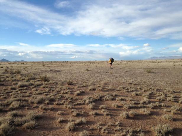
The next day was similar in many ways to our second day. There was lots of cloud cover; I was quite sore, but we made good time, for a twenty-five and a half mile day. The landscape wasn’t as interesting as it had been on the first day, but it was still generally pleasant.
On the 9th we had twenty miles remaining to reach Lordsburg. The last two days our water sources included a mix of caches and windmills. Windmills are commonly used to pull water from the ground to provide drinking water to cattle on arid ranches. Although we carried four or so liters of water at a time, the temperature difference when compared to our previous summer’s hike meant that we weren’t drinking nearly as much water, and we were feeling much better throughout the day. We’d forgotten how easy it is to walk a twenty mile day when you don’t have to take a four hour lunch break in the middle of it to make sure that the sun doesn’t kill you. The twenty miles went fast enough, and we walked right up to the Econo Lodge after a mile or so of road walk through the outer limits of Lordsburg.
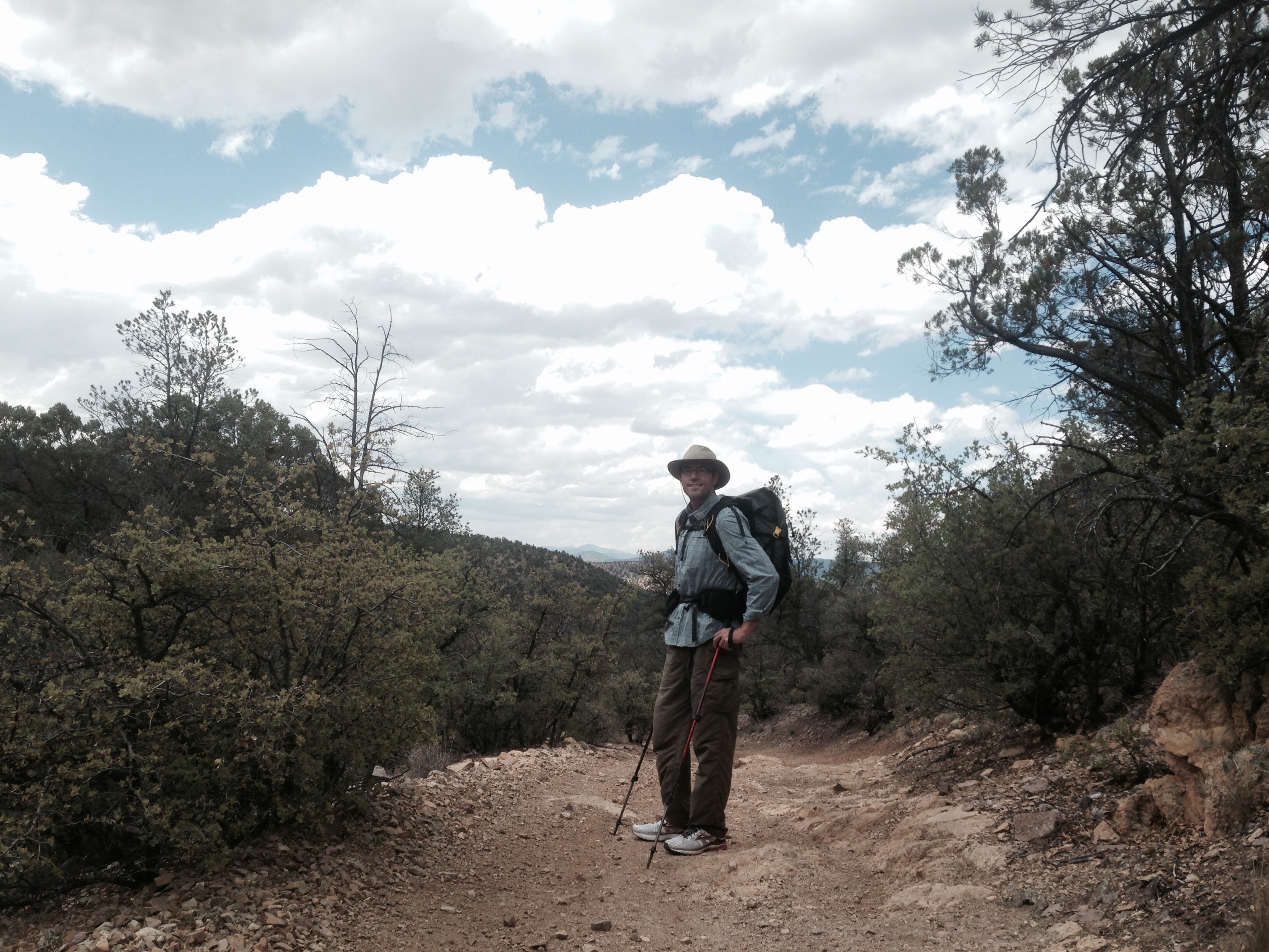
It was tough to get up and leave at a decent hour the next day because I was still feeling sore. The flat terrain left me feeling more stiff than a hike with frequent ups and downs would have. This wasn’t the first time I’d noticed such a trend, and I attributed it to the fact that every step I took on flat ground was exactly the same. Each step was the same length stride and used the same exact muscles. On the other hand, when I am climbing or descending, I use different muscles and different length strides for varying degrees of steepness, mixed in with some flat walking and those types of strides. Anyway, even though we knew we had to hike twenty-four miles our packs were light and our spirits high because at the end of that twenty-four miles we would reach New Mexico Highway 90 from where we would hitch into Silver City. We’d rent a car in Silver City – the same car that would eventually take us back to the El Paso airport – and Matt would use that car to slackpack me over the last thirty- five or so miles between the highway and town over the next day and a half.
The first twelve miles out of Lordsburg sucked. Flat, sandy, barren cow miles that might have killed us had we attempted them in the heat of the previous summer. A young bull got a little aggressive with us, which I did not like. Finally though we began to climb up into the mountains and for the first time that week we walked on actual single track trail. The trail looked relatively new and was beautifully constructed. There were also trees, and ups and downs, overall it was a quite welcomed change of terrain. We reached the road at 5:00, and quickly got a ride. The guy that picked us up was pretty chatty and ironically had just picked up another hitchhiker who was pretty much mute. Matt and I both concluded later that the first hitchhiker probably scared the driver a little, so he probably felt there was safety in numbers and was happy to see us on the side of the road with our thumbs out. We ended up at the Motel Six, and I was happy to be in Silver City again.
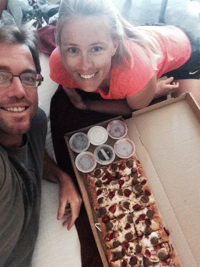
The next morning we picked up our car from Enterprise and got breakfast burritos from a stand that had come highly recommended. Don Juan’s chorizo breakfast burrito was phenomenal, and powered me through the first ten miles of the road walk of my twenty-five miles roadwalk. By the last ten miles though, I was feeling extremely sore. I did listen to four podcasts over the course of the walk though, and knocked the whole thing out between 10am and 4:30pm, so I was pretty pleased with myself. We celebrated with dinner at Little Toad’s Brewery, which I’d been looking forward to since we first started planning the trip, having enjoyed downtown Silver City and this particular spot so much the previous summer.
The following morning I knocked out my last little stretch of road-walking. Matt and I both said numerous times that we wished I was finishing the trail on that trip. It would have felt more like something to celebrate if I had been, and it would have been appropriate for me to finish with Matt by my side since we’d hiked so much of the CDT together. Instead though, I still had the sixty miles to finish that we’d skipped after Matt’s injury in the Gila the previous summer. I didn’t want to drag Matt back out to New Mexico again, so instead I’d convinced my mom and my sister to make the return trip with me over Easter Weekend, just two weeks after I’d finished the Mexican border to Silver City stretch. What we needed to do was to rent a high clearance four wheel drive vehicle so that I could get back to Snow Lake and hike from there to New Mexico Highway 12.
My mom hadn’t been camping since the early ‘70s, and she’s a high strung worrier, so the whole trip required a bit more discussion and explanation than what I’d been used to before, but she was a good sport and it seemed like she was looking forward to the adventure. My sister flew into Albuequerque from San Francisco and by about 11pm or so Mountain time on Friday March 25th, we were all asleep at a hotel by the ABQ airport with a GMC Yukon in our possession. The next morning we took off early to buy groceries and to head off towards the mountains. We had a good drive ahead of us, and I hoped to do some substantial hiking that afternoon to put a dent in the mileage I had to cover over the next forty-eight hours. My mom and Ansley dropped me off at the place where Matt had dropped me off to nine months earlier to begin my walk to Pie Town. I looked over at the trail into the woods that I had taken then, and instead headed the opposite direction down the road. I wanted to run as much as I could that first day while my legs were fresh, just to try to knock out miles as quickly as possible. The winds were extreme, but at least the temperature was pleasant. I did twenty miles, along New Mexico Highway 12, which took me to a forest service campground and community called Apache Creek. The campground was nice, lots of large trees and spacious sites, and there were a few other groups there to enjoy the Easter weekend. We cooked hotdogs on the charcoal grill for dinner, and built a fire over which we roasted Peeps, which was the perfect Easter treat. I was a little worried about starting a forest fire because of the extreme winds, but the fire pit was deep, and we thankfully avoided burning down the Gila National Forest. Ansley and my mom seemed to be enjoying themselves, but the real test was overnight because the temperatures dipped down into the low twenties. None of us were equipped for that. Even though they were both sleeping in the back of the SUV, it definitely got cold in there, and I was cold in my tent as well.
The next morning we piled in the truck to drive up to Snow Lake, so I could begin my hike back down. I say up and down, but there wasn’t a significant elevation gain, and I guess I was actually hiking northbound, but for some reason that language just makes sense to me. Anyway, one of the best things about car camping to me is that when you wakeup, and it’s freezing cold outside, you can blast the heat of the car and warm up quickly. When backpacking, all you can do is pack up as quickly as possible, start walking and hope for the best. I enjoyed our warm, cozy drive, and we saw dozens of elk, which my mom particularly loved. She was consistently impressed with and raving about the scenery. Apparently I’d really undersold it. It was indeed quite nice; I guess I had let some of Matt’s negativity about New Mexico rub off in my memories of it. Finally – after several hours of very slow progress, we reached Snow Lake. The road was actually a lot better than I’d expected, not treacherous, just slow going. I was surprised that there were several groups camping at Snow Lake as well. Though we’d considered camping there, I was hesitant to do so because it wasn’t yet open for the season so I didn’t know if the pit toilets would be unlocked. They were indeed unlocked, and like was the case at Apache Creek, not yet being open for the season simply meant that the water spigots weren’t turned on. I took in the scene at Snow Lake and reminisced fondly about our time spent the previous summer.
Soon though I had to get walking. I needed to put in a full thirty miles that day. Because of the long drive it was after 9am by the time I began. The days were still short in March, and my mom did not want me to still be walking in the dark, so I needed to hustle. Slowly but surely I progressed down the gravel road. Ansley walked with me a good bit, and sometimes they’d drive on ahead and then walk back towards me. They fixed me sandwiches that we ready as soon as I’d arrive at the truck. All in all it was a pretty luxurious setup, though I was still exhausted after a thirty mile effort. Although I didn’t have to walk in the dark at all, we did have to drive in the dark. When I completed my thirty miles we were still almost twenty miles from our campsite at Apache Creek. I had miscalculated the mileage that I’d have to do over that weekend. Had I just stuck to the official Continental Divide Trail, the mileage would have been significantly less, but since I wanted to be able to actually see my mom and sister, during the day and in the evening, since they’d been kind enough to fly out to New Mexico to help me, I needed to take the Forest Service road alternate. It all worked out fine – we returned to our campsite at Apache Creek shortly after dark, and I whipped up some MountainHouse meals, by which Ansley and my mom were pleasantly surprised. I was exhausted, and relieved that the temperature was a bit warmer than it had been the night before, and I slept soundly.
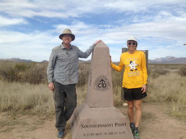
The next morning I woke up early again, so that I could knock out the remaining twenty miles and we could drive back to Albuquerque and at least enjoy a restaurant meal for dinner. I was sore from the previous day, but able to move along pretty quickly. After about six hours, at a random spot, on a random gravel road in the middle of nowhere in southwestern New Mexico, I finished the Continental Divide Trail, and thus the triple crown. I had successfully connected my footsteps from Canada to Mexico, or vice versa at times. It seemed anti-climactic of course. Not just because I wasn’t finishing at an official terminus or at country border or with my hiking partners, but because these things always do for me. I guess if the journey really is the reward then that helps to explain it a bit.
____________________________________________________________
We Made It! July 8, 2015
Whew! We made it to our final destination of Pagosa Springs, Colorado. 165 miles hiked since my last post at Ghost Ranch. We got rained on during each of the seven days we spent on the trail; ironically the only day without rain was during the zero day that we spent in Chama, New Mexico on 4th of July. During our 95 mile stretch between Ghost Ranch and Chama, we were relieved to finally be out of the desert for good. We saw over twenty-five elk, including a few very young calves that made a squeaking noise that sounded like it should’ve been coming from a rodent. We got to spend two nights in developed campgrounds, which was a rare treat – picnic tables, privies, and a spicket with potable water! The first campground (Hopewell Lake) was nearly full with people out starting the holiday weekend a few days early. I feared that the next campground (Lagunitas) would be even more crowded, it now being even closer to the holiday weekend, but instead it was nearly deserted. Only one group (who seemed to be there long term) was present. In my normal (for me) paranoia about semi-deserted developed campgrounds, I worried that they may be cooking meth or engaging in something else illegal. I felt much better though when after the early evening thunderstorms, a young boy emerged from trailer in a full spiderman costume and rode his bike around the campground. They were actually a family that offered us water and enchiladas, and we had a nice night at a picturesque site right on a lake.
Every day during that stretch though, the weather worsened, culminating with our final push into Cumbres Pass (where we would hitch into Chama via hwy 17) when we got a pretty scary thunderstorm complete with hail and torrential rains that lasted for several hours. We arrived in Chama and began to attempt to find a room, not realizing at first that this could be a challenging task, being that it was 4pm on Friday July 3rd. Finally, we found one at a motel on the far end of town, which was the cheapest place in Chama at $42 a night, and adequate as far as cleanliness and such goes. It was also right across the street from the grocery store and Laundromat. The only downside was that the woman who owns the place is a complete lunatic. Thank God we didn’t have any beef with her, as she claims to like hikers, but she ranted and raved about other guests, threw a family out of the hotel, and told us stories about changing people’s rates if they acted “nasty” towards her. We laid low for the next two nights and I haven’t seen any suspicious charges show up on my credit card.
I always enjoy trail town fourth of July celebrations. Although Chama didn’t offer a parade like Lincoln, Montana or a pancake breakfast like Independence, California. They did have more fireworks enthusiasts per capita than anything I have ever witnessed. In the run up to the actual fireworks display locals were shooting off their own fireworks with such frequency that I wasn’t sure if the official show had actually begun. Even when the show did get started shortly after 9:00, there were numerous competing shows being put on by individuals, some of which continued well into the night.
We met our first other CDT hikers of the summer in Chama – an older couple named Cisco and RoadRunner. It was really nice to be able to talk trail with other hikers, in a way that I totally took for granted on my other hikes. Cisco and RoadRunner also secured a ride for all of us back to the trail at 8am on the 5th. Matt and I had studied the maps and looked at the weather forecast, and decided to take a low route alternate on forest service roads for the first two days so that we wouldn’t be up on the exposed ridges during the daily storms. That turned out to be a very wise decision. We bid farewell to Cisco and RoadRunner who after some hesitation, decided to stick with the official trail. The forest service route was nice; we walked for many miles along the scenic Conejos River, seeing many individuals fly fishing and camping.
The rain began early in the evening on our first night out (the 5th). For only the second time ever in my use of this tent (the first time being in Oregon on the PCT), the tent flooded during the night. Matt’s thick blow up sleeping pad kept him up off the puddles, but my pitiful foam pad saturated quickly, I woke up in the middle of the night completely drenched. I wasn’t able to sleep much after that due to being cold, as down sleeping bags offer no warmth once they are wet. We started out shortly after 6am on what was supposed to be a 32 mile day. Despite some clouds, we were able to lay some of our stuff out to dry at our 11am break. We stopped at the tiny mountain community of Platoro to eat second lunch around 12:30. We were already 17 miles into the day. Shortly after that though, it began to rain. It rained on us from 2:00 until about 6:00. The rain was steady and cold, and being completely soaked to the bone, I was shivering and needed to continue moving to maintain any degree of warmth. Luckily thunderstorms never hit directly on top of us, and the rumbles of thunder stayed in the distance. At mile 32 on the day, we reached Elwood Pass, where we had planned to get back on the trail. After some discussion, we decided to stick to the forest service road. The point of being on the trail was to enjoy the scenery of the southern San Juan Mountain Range, and it seemed pretty obvious that we weren’t going to be able to see the scenery. Plus, we didn’t want to get any higher and more exposed. We walked on for a few more miles and set up camp beside the road. We did get a brief respite from the rain that allowed us to set up the tent and cook dinner and dry out a bit.
Although it rained all through the night, and the tent flooded again, every time I woke up I still felt confident that it would stop before the morning. I mean, there isn’t morning rain in the summer in Colorado, right? Wrong. We hadn’t planned to get too much of an early start anyway, having walked 35 miles the day before and only having about 16 or so to go to the highway. We waited and waited for the rain to stop, and finally gave up shortly after 8am. Getting out of a tent and breaking down camp in the rain is just the worst. The dread was probably worse than actually doing it. We finally did so, and got walking as quickly as possible. We couldn’t take any breaks because it was so cold, and thus made really good time, covering 16+ miles in about five hours. The rain broke before we reached the highway, which I was glad about – having envisioned us standing in the freezing rain with our thumbs out for hours.
We reached hwy 160, the same highway I had road walked with the sobohobos at the end of my 2013 hike when snow had pushed us out of the mountains. Thus my experience hiking in Southern Colorado thus far has been shaped by bad weather and road walks. Still though, I was relieved to have made it. Over 500 miles of hiking over the last month has gotten me a lot closer to my goal of finishing the CDT and thus the triple crown. Matt was a great sport to endure pretty miserable conditions over much of the states of New Mexico and Colorado.
After a lively and incredibly fortuitous hitching experience, we are now in Durango, Colorado and in the possession of a rental car. We have three weeks to explore Colorado’s trails and mountains beyond the CDT. I am hopeful the weather will improve, but either way now we have Matt’s heavy duty Coleman car-camping tent, which is going to feel like a castle after being in my tarptent for the last month, as well as a vehicle, so I feel a lot less vulnerable. Will definitely continue to post pictures and report from the road.
Ghost Ranch – June 30, 2015
We reached Ghost Ranch yesterday afternoon after 55 miles of hiking from Cuba. This section flew by, being almost exactly half as long as our previous stretch between Grants and Cuba. Leaving Cuba we lingered waiting for the heat to abate and knowing that we only needed to hike fourteen miles on the day. We checked out of our motel room at noon, and ate lunch at a local bbq joint. I decided to go with the brisket to spare Matt the critique that would have inevitably occurred had I chosen the pulled pork. We sat there until we felt we had worn out our welcome, and then moved down the road a block and enjoyed ice cream and free wifi at McDonalds. Finally we moved on to Subway where we purchased sandwiches to pack out for dinner later that night and cherished a few more minutes in the air conditioning. Finally at 3:00 we hiked out. After several miles on the road we hit the trail and begin climbing. Immediately we were greeted with frequent running streams. I hadn’t seen a running water source since the Gila, and these were really a sight for sore eyes. Along with the streams, and a few thousand feet of elevation gain was increasingly verdant vegetation. We were quite ecstatic to be out of the desert, even though we knew that we’d be dropping back into more arid climates within a day. We had an awesome campsite by a creek, and had a quick night since we had our Subway sandwiches and did not have to cook. Although I eat Subway fairly frequently, I can count on one hand the number of times I have really enjoyed a Subway sandwich, and this was certainly one of them.
 The next morning we got started well before 7am, shooting for a twenty-six mile day and aware that we would have a bit more up and down than we had grown accustomed to. We started out walking several miles through dewey, muddy meadows, but I never complained about my wet shoes, just thankful that water was all around us for once. We made good time until about four o’clock when a thunderstorm moved in, and we began to get hailed on. I swear it seems that rain is always accompanied by hail in the Rockies. Within two minutes of the storm beginning, we crossed a forest service road and saw a small, very well built shelter. I have hiked over 2,400 miles on this trail, and with the exception of a few ski huts further north and a ranger station or two in Montana, I have never seen any sort of shelter on trail. Yet, here it was right when we needed it; the ultimate trail magic! The shelter did not have walls or a floor, but it kept us dry for over an hour and a half while we waited out the storm. We began hiking again around 6:00 and still made it to our planned campsite well before dark.
The next morning (Sunday the 28th), we descended several thousand feet to the Rio Chama before beginning an eleven mile road walk to Ghost Ranch. We were definitely back in the desert – check out the video below for a visual – but we kept on moving through the heat, and made it to Ghost Ranch by 2:30. Ghost Ranch is a Presbyterian Retreat center that feels kind of like a summer camp for adults and families. Those who know how much I like summer camps will correctly guess that I really like it here a lot. We set up our tent in a site with a covered area and picnic table, took showers and did laundry. I have heard a lot about the food here, and indeed it is good, but honestly a little too healthy for us to get the calories we need. The best part has been that we met an amazing family that volunteers here all summer. The dad, Matthew, is an accomplished ultra-runner and is very interested and enthusiastic about long distance hiking. He and his wife Juliana (who teaches painting here) have four kids, who are young but very outgoing and knowledgeable about running and hiking and very lucky to be growing up spending their summers in a place like this. We hung out with them all night. We have met so few people on this hike that the few that we have met and connected with are cherished even more. Today we have been relaxing and waiting for a package to arrive. We will head out bright and
Desert Days in New Mexico – June 26, 2015
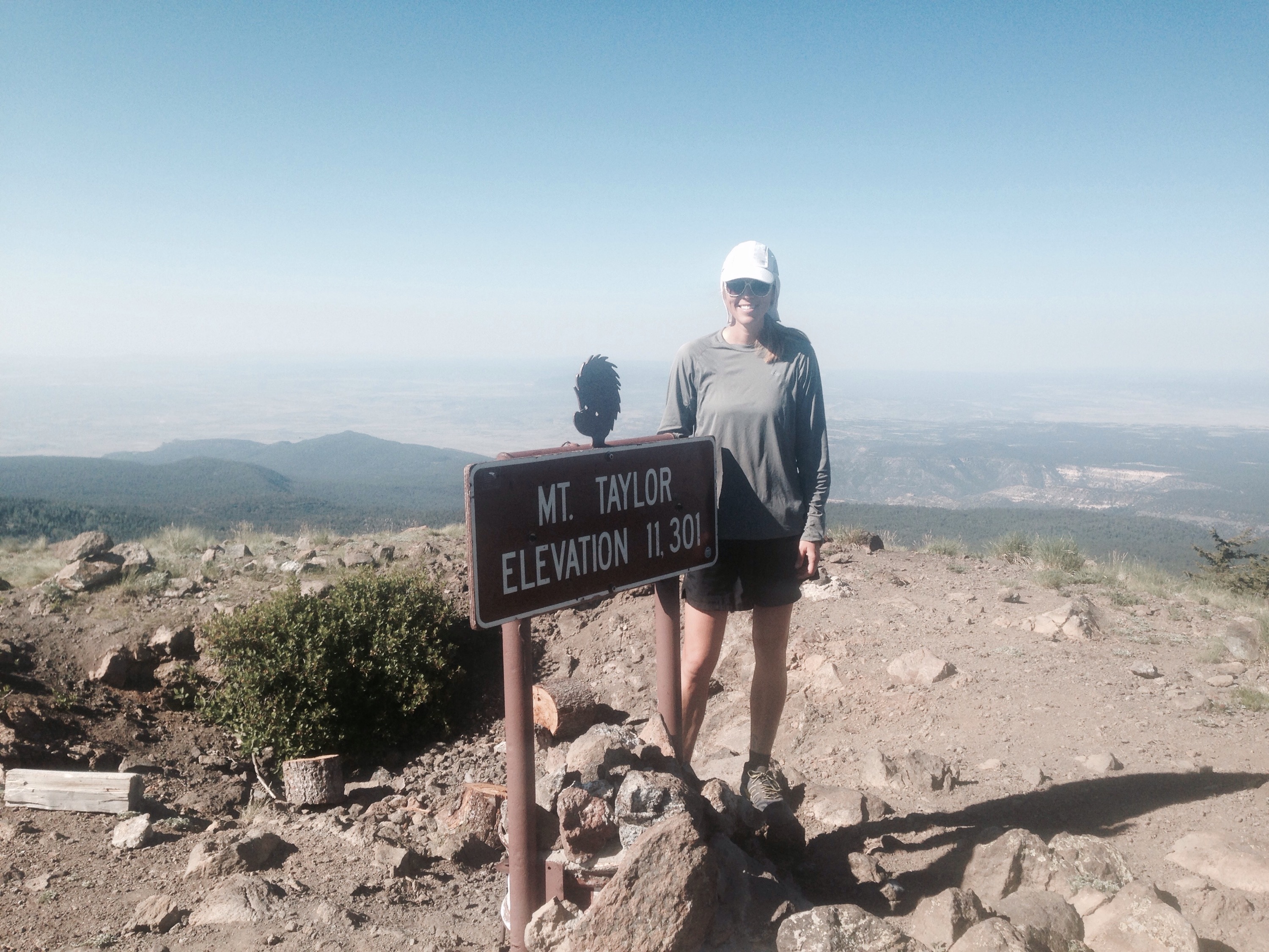
Oh New Mexico! So many times over these almost three weeks of hiking I have been on the verge of posting a rant that New Mexico is the worst state I have ever hiked through. But then each time that I think it can’t get any worse, New Mexico redeems herself with a respite from the seemingly endless scrubby, arid cow fields with something magical. In the 110 miles between Grants and Cuba (where we are now) there was a lovely hike up above 11,000 feet to the peak of Mount Taylor, and a full day of climbing in and out of otherworldly canyons.
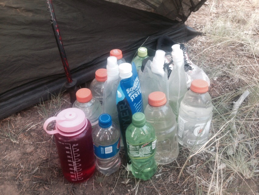
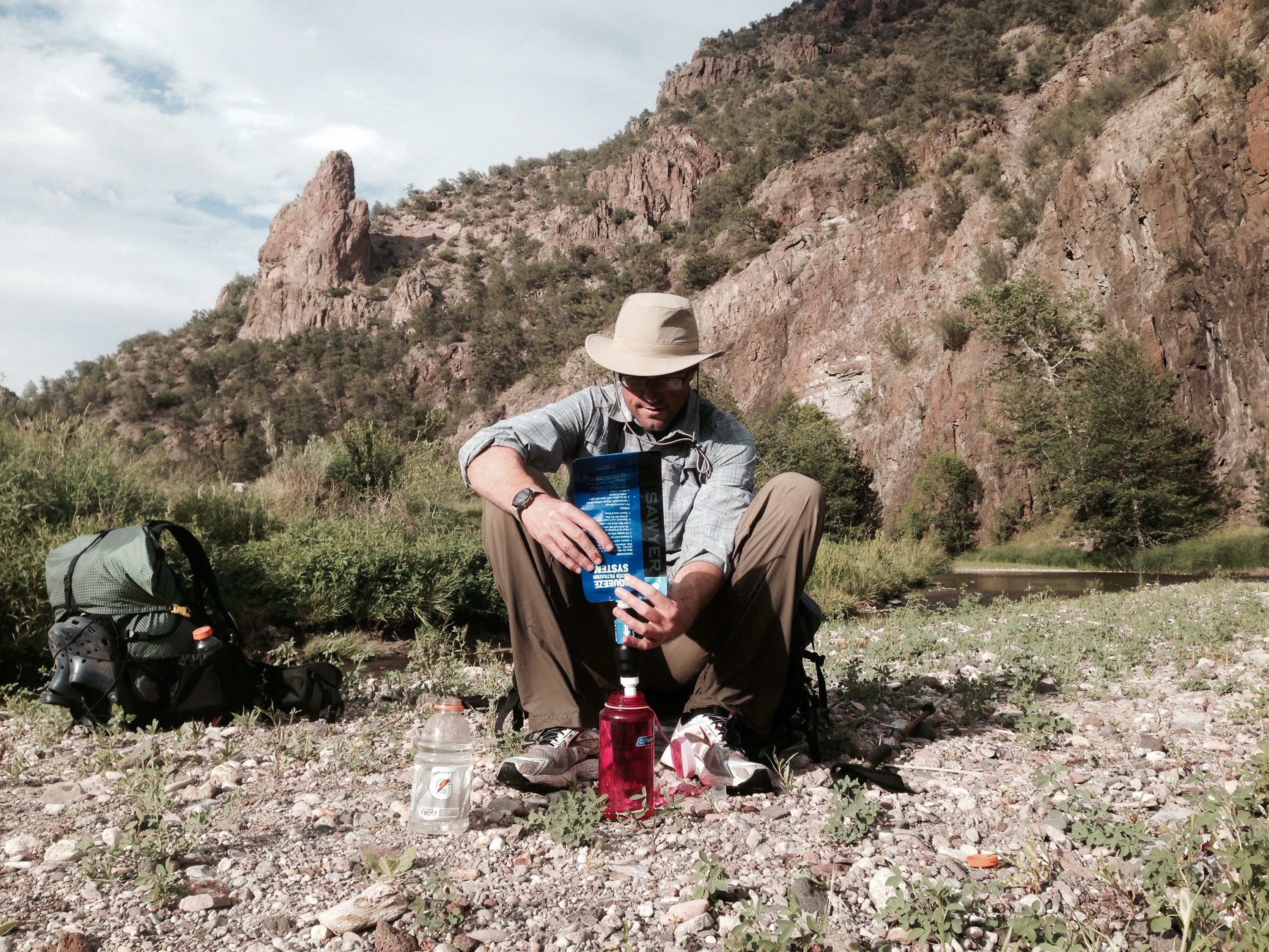
Otherwise though this section had more than a usual share of hardship. The temperature were in the 90s each day, and water sources were few and far between at times, so we typically carried six liters of each at a time. Here is a shot of all our water bottles filled and ready to go…
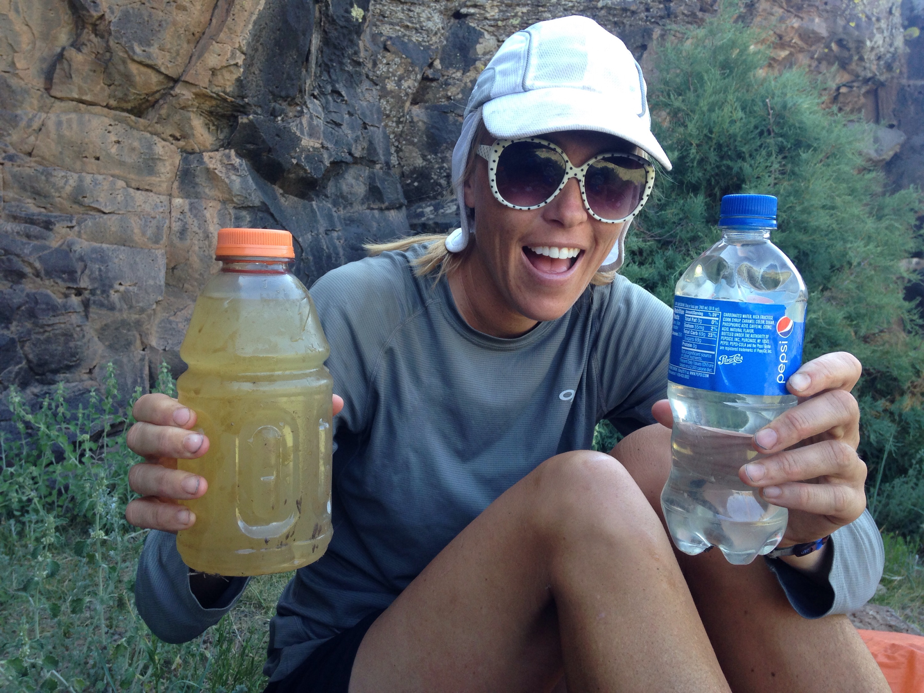
Despite the fact that we were drinking 10 liters a day, we constantly felt dehydrated. Then there was the quality of the water sources. Below is a shot of water from a muddy cow pond before and after filtering with the sawyer squeeze. Seriously that filter was the best purchase ever!
 Some sources were much better than others though. Matt excitedly described the water in one tank as “pristine.” You know you’re at a certain point in your life when you’re using words like pristine to describe water you’re about to drink out of a cattle trough. Here’s a picture of another water source. Matt is reaching down into the tire to access a spicket.


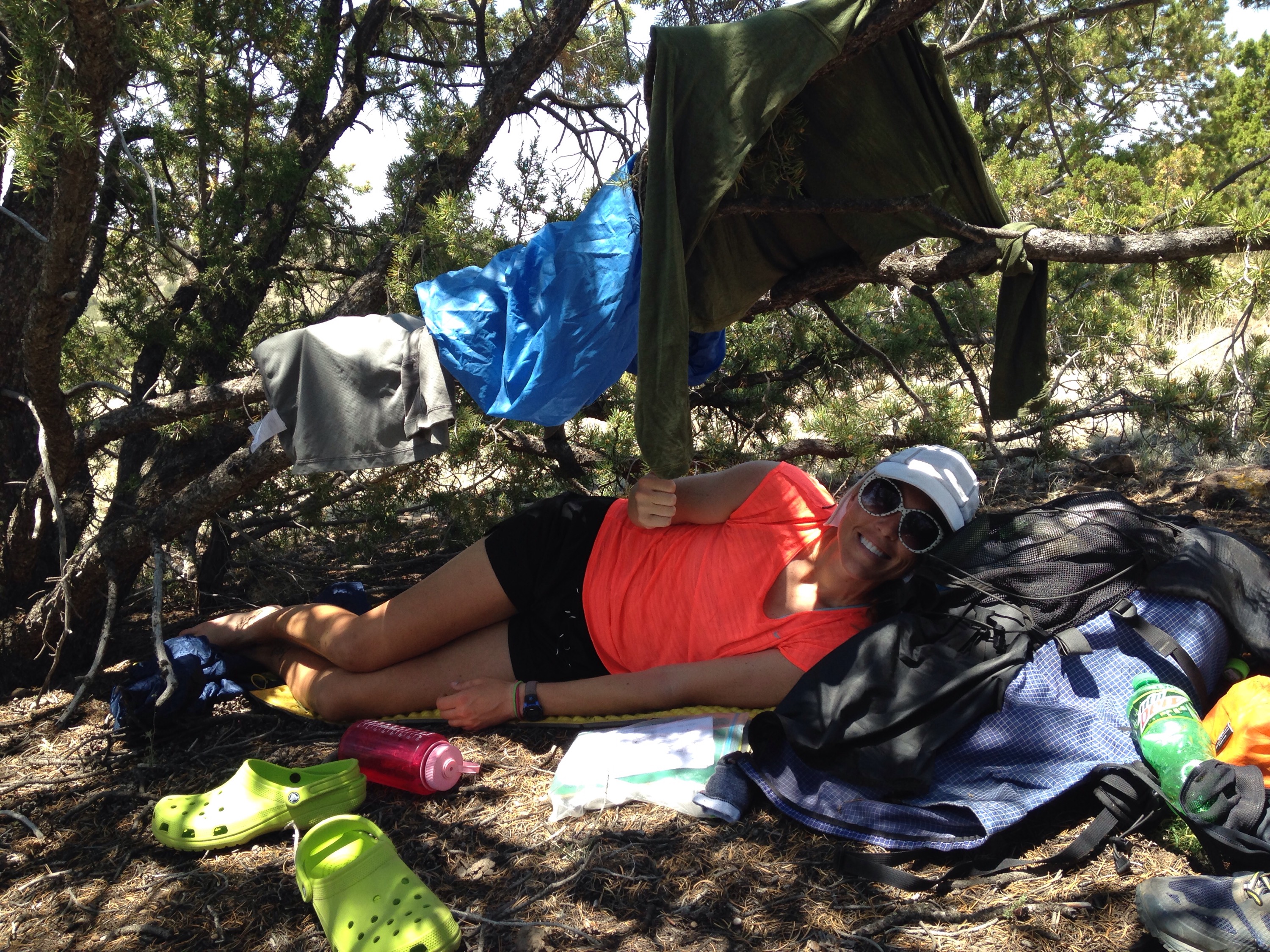
This picture of me resting by the tire-spicket embodies the toughest part of this section – the exposure. With few trees, it was tough to find any respite from the sun. We certainly tried though, laying up under what ever shade we could find – or create – for about three hours in the middle of the day.
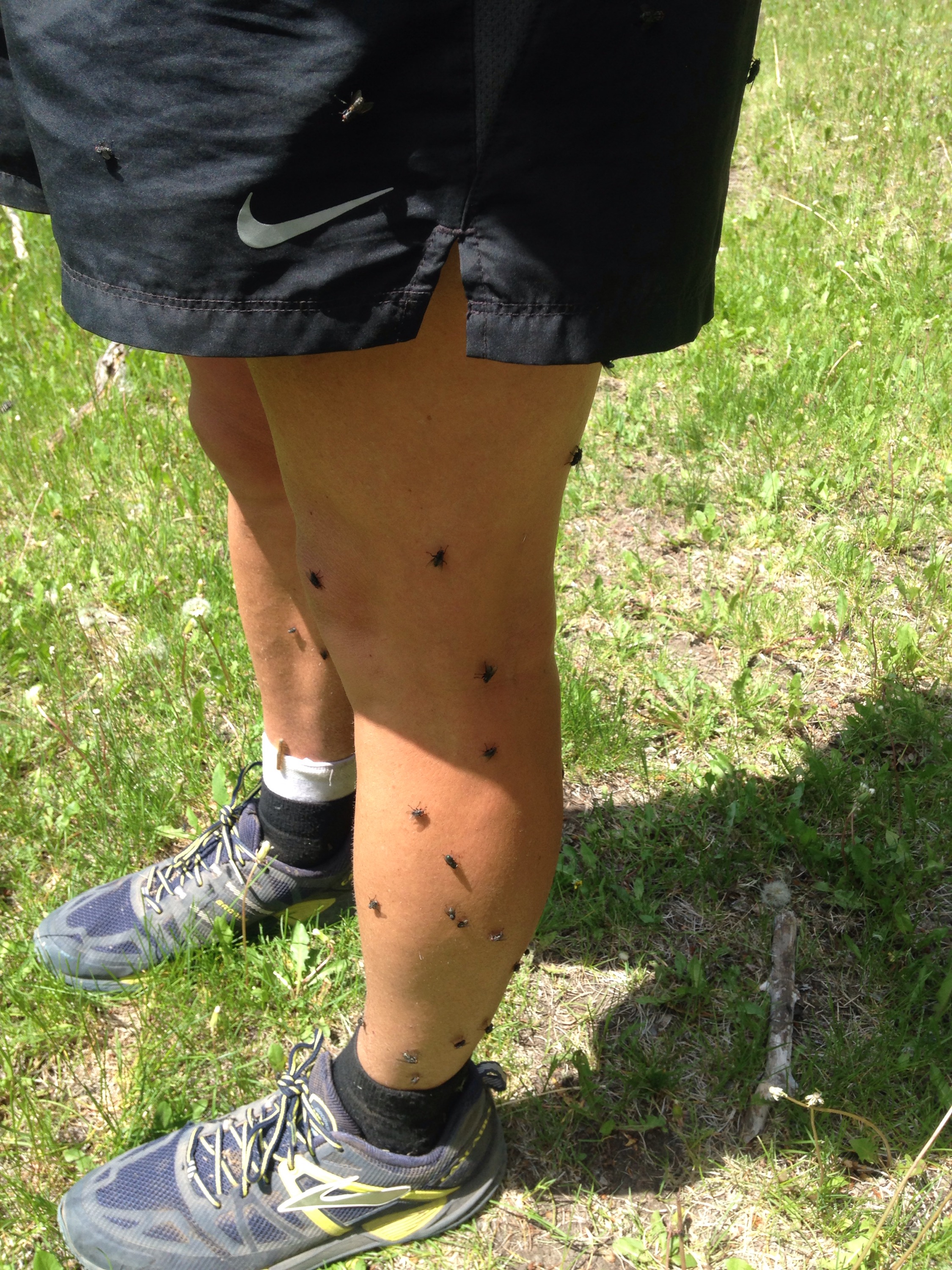
 There was other stuff too, like the time that a discrepancy between two different sources of information created confusion that led to us not finding an expected water source and having to go to bed thirsty and uncertain about where we’d find water next. Then there was the time that Matt tried to wade into a muddy pond to access the water in the middle and ended up sinking down to his knees in mud. He almost lost his croc to the mud and only rescued it by plunging his arm down into the mud to pull it out. He spent the next 18 hours covered in mud and manure until we found enough water for him to clean off a bit. Unfortunately I don’t have a picture of that memorable scene, but I do have one of the time that I had 35 flies on my leg at one time.
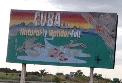
We can laugh at all of these “type two fun” moments now that this section is behind us. Also Matt’s ankle seems to be at 100% which is such a great relief. We did not arrive in Cuba until 8:30 last night after a 31 mile day, so we are enjoying a zero day today. Cuba has a reputation for being a little bit run down, but it works perfectly for us. There are several food options, and consuming a lot of calories is our main priority. The manager of the little hotel we are staying at is very hiker friendly as well. Today she made us homemade spring rolls and brought them to our room. With our longest sections behind us now, and over 300 miles total in the books, we’ll head north tomorrow towards higher elevations, more trees, and hopefully cooler temperatures. In the meantime here is a TBT to last week when we were grubbing Pizza Hut in Grants, as well as a lovely Cuba billboard. Until next time…
Slack Packing June 19, 2015
From the 14th to the 18th I hiked 115 miles. Yes, it was on mostly dirt roads, and no, I did not have to carry my gear because Matt was slack-packing me, but it was still surprisingly exhausting. Over the course of these days I hiked two 25s, and a 30, and I think it is too early in this hike for me to be doing this type of mileage. Most days I was pretty debilitated both in terms of muscle soreness and overall exhaustion by the end of the hike. Thankfully, Matt was an amazing sport about slack-packing me, and would have the tent set up and dinner ready to go wherever we were camping.
After a quick 10 mile hike on the morning of the 17th, Matt picked me up and we drove to Albuquerque to return the car. From Albuquerque we took a greyhound bus back to Grants, New Mexico. Riding the greyhound was quite an experience, as bus travel always is. There were quite the cast of characters on this bus, many of them heading to Vegas or LA from the east. At one point, as we passed a fairly diminutive mountain range just west of Albuquerque, the young man in the seat in front of me exclaimed, “OMG! I think I see Mount Everest!” Meanwhile, Martín regaled the passengers with stories of the high-speed chase that landed him in prison, and Chelsea explained the nuances and benefits of sugardaddy.com.
We are arrived at our hotel in Grants before 8 o’clock, and settled down to rest up for Matt’s first day of walking since before his ankle injury 8 days earlier. We got up early yesterday, and began to walk south from our hotel in grants back to La Ventana Arch National Monument where I had left off the day before. It was a 25 mile walk, which I worried was overdoing it for Matt’s first day back, but of course he handled it much better than I did. We arrived at our destination around 4:30 and hitched back to town without too much problem. Last night, we ate at a Chinese buffet that had ice cream included as part of the buffet. I repeat there was AYCE ice cream. I think I have been running a bit of a calorie deficit thus far, so I took full advantage of the opportunity to try to rectify that. We were supposed to hike out this morning, but I decided that I could really use a full day of rest, so we are still here in Grants.
Despite all my whining, there were some really pleasant parts of this last week. First off, I am really grateful that I had the opportunity to put in some big miles without carrying my pack and the huge quantity of water that would have been required to hike this section without support. Also the first day of hiking was particularly nice, with a summit of Mangus Mountain and awesome views from the top of its fire tower. Shortly after coming down from the mountain, I saw a bear about 20 yards away from me. He didn’t notice me, so I watched him for just a second and then clanked my poles and hollered to scare him off. I was only a little scared when I realized that the trail switched back just below the hill where he had run off. I had to sing and talk to myself for a while after that to make sure that he would hear me coming so that I didn’t surprise him again. I didn’t see the bear again, but I did see three elk later that afternoon.
Another highlight was meeting numerous bikers who were competing in the Great Divide Mountain Bike race. I can’t remember if I wrote about this in 2013, but the GDT mountain bike route runs a similar course to the CDT that I am on. The two trails aren’t identical because they stick mostly to forest service road rather than single track, but we do cross paths often. Although many people ride the route just for fun, there is also a loosely organized race from Mexico to Canada or vice versa. This year eight participants started at the Mexican border, and I met most of them over the last few days. They are all really neat people, and one of them, named Gabe, was a physical therapist from Montana. He graciously examined Matt’s ankle and gave a really positive report, which gave us confidence heading into Matt’s first day of walking yesterday. Hopefully we will begin meeting the southbound bikers soon. It is crazy to think they will bike this entire route in about four weeks.
Tomorrow we will head north for Cuba, 110 trail miles away. It will be really nice to be back on trail, and off the roads. Although it would be nice to be able to take it easy so that Matt’s ankle can get back in shape, that is not really an option because water sources are few and far between. Fortunately, this is the last section in which water will be a major concern. Hopefully I can post again from Cuba in about five days.
My view for many, many miles… 
La Ventana Arch 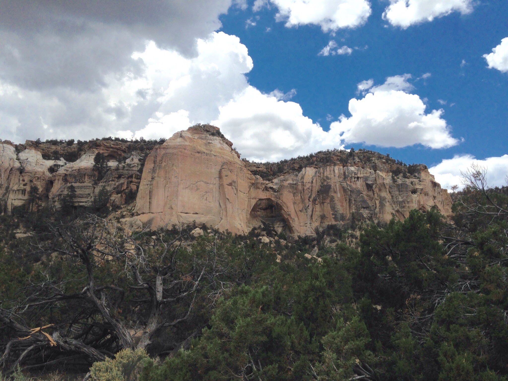
The next day started out great. Although we were still crossing the river frequently, we began to have longer stretches of actual trail – “land walking” we were calling it – and were making good time. Then, around 11am or so, Matt sprained his ankle. I should have known it was serious when he twice tried to stand up and had to sit back down when his vision blacked out. For some reason though I still thought it was just a simple rolled ankle – like I do all the time. There really wasn’t anything to do but continue to hike, so I took some weight out of his pack, and we slowly and carefully continued on. We decided to stop for lunch an hour later, and I was horrified to see the huge egg on the outside of his ankle. We had planned to camp at a place called Snow Lake that night (Wednesday) because Snow Lake was officially the end of our trek through the Gila, and because it was a campground with running water, pit toilets and picnic tables. Thus it had seemed like a worthy destination. I kept suggesting to Matt though that perhaps we should just camp where we were, not seeing how he could possibly walk the remaining 10.5 miles to Snow Lake on that ankle. He was pretty set on trying to make it to Snow Lake that night though, saying he just wanted to be out of the wilderness and the river. In retrospect, that was a good decision because in the morning his ankle had really stiffened up and worsened.
As we slowly continued on, the canyon began to open up, which meant that we had more navigation choices. Unfortunately, we chose poorly. On not one, but two occasions we followed the wrong river bed. First, we traveled up Iron Creek for a full mile before realizing our mistake. Once we did realize how far off trail we were, I didn’t think there was any way we could possibly make it to Snow Lake before dark. It was really a low point. Then, when we were less than two miles away, we did the same thing again, following Gallita Creek. Fortunately this time, we realized after only a quarter a mile or so what we had done. We reached Snow Lake around 8:45, just as dusk was setting in. Even though we had no idea how we were going to proceed, just being there was a tremendous relief. By this point Matt’s ankle was absolutely huge, a hugeness which was by the morning accompanied by dark purple discoloration.
The next morning, Matt could barely walk to the privy. At first we had hoped that maybe one day of rest at Snow Lake would leave him able to continue on, but it became clear pretty quickly that this would not be possible. Although Snow Lake is a car campground, it is 40 miles up a very rough gravel road, so hitching would have been unlikely. When we arrived at the camp on Wednesday night, there were two other groups camping. The campground was spread out though, and we didn’t camp near or speak to either of the other groups. In the morning one group departed before we emerged from our tent. As we began our day or reading and resting, and – in Matt’s case – elevating his ankle, the one remaining group passed near our campsite while heading out on a day hike. We overheard them mention that they were heading to Silver City, and we pinned all our hopes on the idea that they might be able to give us a ride. We had to wait all day for the group to come back from their outing, and during that time we worried that they would not be likely to help us. They were a group of two moms with three kids between them, and they had only a midsize SUV. How would we all fit? Would they even want expose their children to smelly vagrants?
When they finally returned, I approached the mom that was in the lead of the group – Nan. Nan immediately marched over to where Matt had his foot propped up at the picnic table, giving him a compression sleeve, celebrex and aleve. Her friend Kate, who happened to be a nurse, arrived shortly thereafter and examined him. They didn’t know at that point, exactly how things would work out, but were certain that they would somehow help us, even offering us to take their vehicle for a few days. Very shortly after the group departed for their own campsite, they sent the children back over with wine and chocolate. Later in the evening the whole group came to hangout, and I was blown away by how kind, fun, interesting, generous and crazy this crew was. Somehow we found ourselves in very good spirits after just a short while in their company.
The next morning we loaded up their vehicle to its capacity and beyond. We had to use the duct tape that I have wrapped around my trekking pole to keep the rooftop luggage carrier closed. The kids were amazing sports as we smashed two of them in the backseat with me and Matt and our backpacks. Freya, the littlest sat on her mom’s lap in the front seat. The day was quite the adventure overall, but after three hours of packing, four hours of driving, an amazing lunch at a roadside cafe (the food in New Mexico is really good!), we arrived in Silver City at 4:45, and parted ways with our new friends. I have read that the best way for parents to teach kids to be empathetic is to simply set a good example for them, that actions speak much louder than words in this regard. All I can say is that these three kids witnessed enough generosity, selflessness and kindness in one twenty-four hour period that they are probably set. However, I’m sure that their moms are probably setting this type of example for them everyday. Seriously, long distance hiking really does wonders to restore my faith in humanity.
So at 4:45 on Friday afternoon, Matt and I found ourselves in Silver City. We didn’t know what our plan was, but decided to rent a car before the Enterprise closed for the weekend so that we would have a bit more autonomy and flexibility. Our first task was to buy Matt an ankle brace at Walmart, which he followed by numerous rounds of icing. Today (Saturday) his ankle if feeling much better, and looking a little better as well. It is still quite swollen, but he can walk normally. After much discussion and thought, we have decided that he will spend the next four days slackpacking me so that I can continue to make mileage, and he can heal. For those that are new here, slackpacking means hiking without carrying all of your gear. A lot of the trail in south central New Mexico is on dirt roads anyway, so I can hike, and he can drive on ahead and set up camp for us. I am optimistic that I can manage 25 + miles a day hiking mostly on roads without a heavy pack. We returned our Enterprise rental car in Albuquerque and have a new one from Alamo for $9.67 a day. No joke! I really don’t know how that company can turn a profit with rates like that. Anyway, we are optimistic that Matt will be able to hike again on Thursday. That will be a full week off. Since we are out here for so much longer though our priority is for him to properly heal, rather than to rush back into it and risk re-injury. His progress thus far is encouraging. We have hiked 85 beautiful miles so far.

Back on the CDT! June 9, 2015
Hello from the Gila National Forest in southern New Mexico. Matt and I are back on the Continental Divide Trail, with hopes of hiking 650 miles from Silver City, New Mexico to Pagosa Springs, Colorado – where I left the trail at the end of my 2000 mile southbound hike from Canada in 2013.
Our teaching schedules prohibited us from leaving Georgia before early June, so we are about a month behind most northbound thru hikers. Also because of our schedule restraints, it was not practical to begin our hike at the Mexican border. New Mexico in the summer is hot and dry, and even with our chosen starting location of Silver City (150 trail miles north of Mexico) we have serious concerns about the availability of water sources.
After traveling from Atlanta to New Mexico on Friday, we left Silver City on Saturday, with the intention of hiking 17.5 miles to an expected water source. The hiking was pretty easy, and we enjoyed scenery that reminded us both of old Western films. I was a little uncertain about our campsite, because the water report stated that a hermit lived there. I was quite surprised when a well-groomed and friendly middle-aged man approached Matt and me as we set up our tent. It turns out that Doug has been living in the Gila for 16 years as a Catholic hermit and only travels to town once a year to resupply. He showed us his garden, and Indian artifacts, and provided us with filtered water. He was most definitely the most gregarious hermit I’ve ever met.
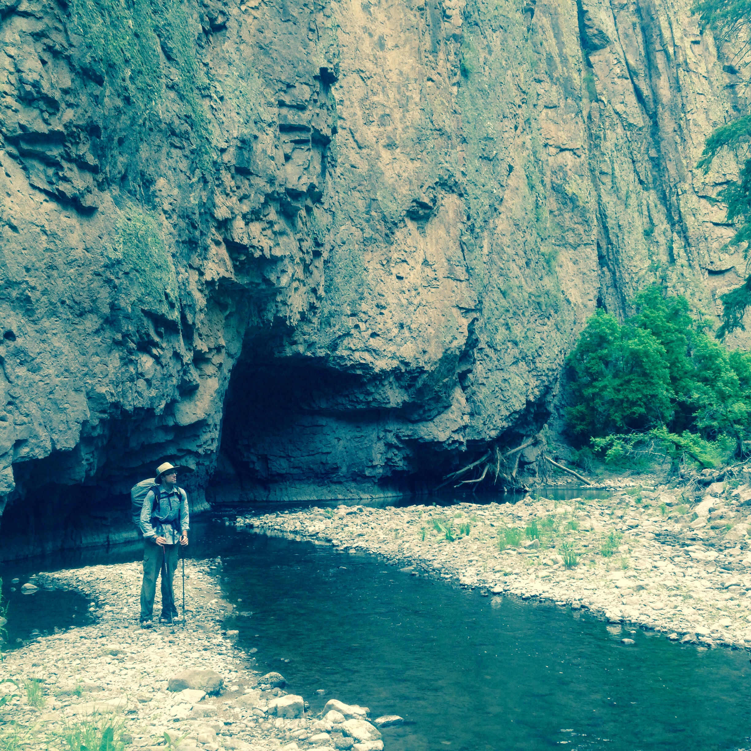
After twelve miles of hiking on day two, including a significant climb, and a long, steep descent, we reached the much anticipated Gila River. The Gila River section is a renowned section of the CDT because it is stunningly beautiful and unique, taking hikers on a sixty mile walk through a deep canyon. Although the hiking is not physically difficult, since it is mostly a flat section, in our first day we crossed the river at least twenty times, which makes for very slow going. Lucky for us, at this time of year the Gila is less than knee-deep, and the cool water feels great while hiking in the hot June sun. That being said, navigation can be frustrating, because much of what trail ever did exist was washed away by a massive flood in 2013. Sometimes the best route seems to be to just hike straight upstream in the middle of the river. We spent a lot of yesterday bushwhacking, including a section through chest high grass which aggravated my allergies and kept me sneezing pretty much constantly for the rest of the day. I do think Matt and I are getting better at the navigation though, and we still have several more days to practice and enjoy the canyon.
Tonight we are staying at an RV park across the road from Doc Campbell’s post, where we mailed our first resupply box. Even though we have only been out for three days, the shower felt amazing. We have a six day stretch had of us to Pie Town. So far, we have seen seven wild turkeys, a bunch of deer and rabbits, and some crazy ducks that run on the water. Until next time…
We arrived in Pagosa Spring – the last Colorado trail town – on the 13th. The plan was to leave town early the next morning, allowing me to hike the final 75 miles to Chama in three days and still have time to travel to Albequerque for my flight home on the 19th. The next morning though, Bigfoot was too sick to hike, and everyone else’s motivation was low. BR and Moosie were willing to hike out with me, while Grinder and Raffle would stay behind with Bigfoot. I knew BR really wanted to stay in town and spend time at the hotsprings though. I felt quite torn about whether or not to push on or spend one last day in town with everyone. Ultimately, I decided that Pagosa Springs would be a good place to finish my triple crown when I return next May, and called it quits for the year right there. Once I get home I’ll post more about my feelings on all of this.
Anywho, we had a great day enjoying the hotsprings. The next day (yesterday), Bigfoot and I hitched 50 miles to Chama, New Mexico, while the rest of the crew hit the trail. Bigfoot is still too sick to hike, and decided to skip ahead and wait for the rest of the group to catch up (he may come out to meet me for this last section next summer). We stayed overnight in Chama. Today we attempted to take a bus towards Santa Fe, so that I could make progress towards my flight out of Albequerque, and so that Bigfoot could see a doctor. We managed to miss the bus and instead began hitching. An RV driven by a Swiss couple pulled over and said they were going to Taos. We looked at the map and saw that Taos wasn’t really where we needed to be heading. But on the other hand, Taos is supposed to be a neat town, so we hopped in. By the time we arrived, we’d figured out that BF could see a doctor in Taos, and that we could both catch busses tomorrow morning – BF back to Chama and me to Santa Fe. So…we are in Taos for the night now. I enjoyed walking around downtown this evening while BF hit the clinic. Diagnosis – giardia. The meds should have him fixed up and back on trail in no time at all. As for me, Albequerque bound, via Santa Fe tomorrow.
Taking the Long Way Around – October 11, 2013
I apologize for the long delay between posts. After leaving Salida way back on September 29th, we hiked 100 miles over four and a half days. The hiking was pleasant, but the scenery was not as spectacular as some parts of Colorado have been. The fall foliage of the aspen trees provided the highlights of the route, as did our ascent up San Luis peak, my first Colorado 14-er. The weather was decent, and overall my experience of this section was nondescript but generally enjoyable.
We arrived in the quaint town of Lake City Colorado on October 3rd. I didn’t post a blog while we were in town because I spent pretty much the entire time completely indecisive about what was going to happen next. At this point on the trail, we had to decide whether to take the Creede route or the San Juans route. The San Juans route would take us 118 miles to get to Wolf Creek Pass. The route is extremely high and exposed and known to be one of the most scenic sections of the entire Continental Divide Trail. However, because of the elevations, most southbound hikers who arrive at this junction after October 1st do not take this route due to the likelihood of winter weather. The Creede route walks directly through the town of Creede, and only requires 45 miles of hiking to reach Wolf Creek Pass. We arrived at this junction almost a week into October, but the weather.com 10 day forecast didn’t look too threatening.
My personal preference was for the Creede route. I have loved, loved, loved Colorado, but knowing that my hike would be ending within a couple weeks, I was anxious to reach New Mexico. Also I tend to err on the side of caution and did not want to run into any dangerous winter weather situations. You rest of the group, however was dead set on doing the San Juan route, and I decided to join them rather than to venture out on my own (much inner turmoil accompanied this decision).
We left Lake City for the San Juans on October 6th. Our departure was delayed for one day when Moosie contracted food poisoning. Luckily she recovered quickly and was a trooper to persevere. The first day out we cut our hike short both to allow Moosie additional time to recover and because we had the opportunity to stay in a trail side yurt with a wood burning stove. How could we possibly resist?
The next two days were long and hard, and for me at least involved a bit of night hiking. Now that darkness comes shortly after 7 p.m., it has been difficult to get in a 24 mile day through snowy rugged terrain without a bit of night hiking. Admittedly though the San Juan scenery did not disappoint (see a few photos below). On the third day Moosie crossed a forest service road at the same time that a vehicle passed by. She chatted with the driver, who warned her that winter weather was approaching. After much debate and discussion among the group we decided it would be prudent to drop off our high route. By taking a side trail for 7 miles and connecting to a forest service road we were able to drop down to 9,000 feet. Down on the forest service road we were able to talk with some elk hunters who warned us that “blizzard like conditions” were predicted for today.
We camped last night, and then walked to the highway today to hitch in to the town of Creede. While “blizzard like conditions” may be an overstatement, even down here in the valley we have been experiencing snow all day with significant accumulation. I am quite grateful not to be up on the divide where the weather conditions are most certainly much more severe.
I’m a bit frustrated though because over the past 5 days we have hiked 90 miles to get to a point that we could have reached after only 10 miles of walking had we taken the Creede route initially. Actually, we are even further behind because now we have to go back and hike the road walk that we hitched today to connect our footsteps (remember that we want a continuous footpath rather than skipping any space between Canada and Mexico).
Overall though we couldn’t have predicted the weather conditions, & I am just happy that we ran into someone who was able to share an accurate report with us so that we have the information we needed to make a good decision to drop to lower elevations. It is still snowing outside, and we have some decisions to make regarding how to proceed. Creede is another very nice Colorado town, and it will be difficult to leave here if the snow continues to fall tomorrow.


Desperate times…PB and frosting bagels…

September 28, 2013 – Recap of the last week plus pictures…
9/22 – hellish day. Consistent cold rain. Still managed 26.5 miles on the day. Easy to make good time when taking breaks isn’t really an option. Camped at the base of Mount Elbert, the tallest mountain in Colorado and 2nd highest in the lower 48 (after Whitney which we climbed during our 2010 pct hike). Planned to climb Mt Elbert the next morning before continuing south on the CDT.
9/23 – rain overnight turned to snow with several inches of accumulation by morning. We knew the weather was supposed to clear up so we lingered in camp til after 9am, when the snow did indeed stop. We began our attempt to climb Mt Elbert. Less than 2 hours later, we were turned back by insane winds, blowing snow and resulting poor visibility. We returned to our camp, packed up and hiked four miles down to the tiny town of Twin Lakes where we spent the night in a warm, dry cabin.
9/24 – 19 mile day. We were supposed to do an additional 4 miles over a pass, but we stopped short to wait for Moosie. We camped in a snow field. I’d never camped on snow before and would’ve been fine keeping it that way. I lit my glove and a bag of Parmesan cheese on fire with my stove, but a crisis was averted with the ample supply of snow. Very cold and windy night.
9/25 – 22 mile day which began with a challenging and snow covered climb over Lake Ann Pass. Spectacular views from the top. Hiked and chatted a bit with Raffle who has been hiking with us for a few days. He is really enthusiastic about everything and lots of fun. Mostly its just nice to have someone new to talk to as the five of us already know all of each other’s stories. Great day; nice weather; still love Colorado.
9/26 – 25 mile day. Went over three passes. Traversed for about 3 miles at about 11,800 feet or so with 100% snow cover. Didn’t get into camp til after dark, which is about 7:30pm now. Great day; enjoyed the challenge, and the weather remained clear despite increasing winds.
9/27 – woke up to snow which continued throughout our 11 mile hike to Monarch Pass. Didn’t mind being wet and cold too much since I knew we could dry out in town. Got a quick hitch down to Salida. Stayed at the hostel and had a great dinner with nine sobos and one visiting fiancee.
9/28 – zeroing in Salida. Enjoying this awesome town, watching football and letting yesterday’s snow melt. Hostel is booked tonight so one of the employees kindly offered to let us stay at his house.


September 21, 2013
The weather has improved since my last post, but rain has still slowed our progress somewhat, as has the frequency of Colorado trail towns. I have absolutely no power to resist the pleasures of town. After doing a half day out of Winter Park on the 16th, we had an amazing day of hiking along a high ridge with perfect weather. The 360 degree views were phenomenal, and I’m guessing that had we not been socked in by clouds over the previous week, we would’ve been enjoying similar views all along.I am not exaggerating when I say that I saw the best sunset of my life that day. There was a large mountain range to our west, and as the sunset behind it the colors were unreal. Too bad my phone is not very adept at sunset photos. That day we planned to do 28 miles to push into the town of Silverthorne. We were hesitant about spending money on a hotel so soon after leaving Winter Park, but there really wasn’t any decent camping along the trail. BR, Grinder and I took a wrong turn heading down into Silverthorne, which ultimately brought our day’s mileage up to 32. Even though I was exhausted, it felt really good to push myself physically over challenging terrain. Our goal was to make it to the Wendy’s before the closed at 10pm. We made it at 9:50, and somehow I purchased and ate $13 worth of food. In an amazing small world moment, Matt’s cousin Kevin, happened to be driving through Silverthorne the day we arrived. We met the next morning for breakfast. Kevin lives in Florida and was heading back east after a west coast road trip, so the timing really was lucky and random.
The next day (the 18th), we attempted to leave Silverthorne. We packed up, checked out of our hotel room, resupplied and decided to meet up at the Arby’s to eat lunch before heading out. I ended up running the last quarter mile to the Arby’s as a torrential rainstorm complete with thunder and lightning chased me down the road. We sat in the Arby’s for four hours waiting for the storm to pass. When it didn’t, we booked a room at the Days Inn and headed across the hwy towards the Days Inn with our tails tucked between our legs.
On the 19th, we headed out for a 22 mile day, enjoying much improved weather. However, it did get really cold overnight – 26 degrees, and I did not sleep well. Despite the fact that I have tons of clothes (like I was wearing five layers on top and three on the bottom), I am not going to sleep warm enough when the temperature drops below freezing. I am going to have to double up my sleeping bags and use a blow up sleeping pad rather than my regular foam pad. Matt is sending both out for me, and I will pick them up in Salida, but I am definitely worried about the next several nights, as low temps will remain the 20s. Yesterday we arrived in Leadville, Colorado. While hanging out at a coffee shop, one of the employees began chatting with us and invited us to stay at his house. We ended up having a truly great night hanging out with John, Mike and Genevieve at their home. All of these folks work at the coffee shop and are accomplished ultra runners, climbers, mountaineers and triathletes. Super interesting and kind people, quintessential Colorado as far as I can tell. The hospitality in this state continues to impress.
Now that we are significantly south of I-70 and the main ski resort towns, things should get a little more normal for us. I am grateful that we had the opportunity to enjoy town comforts during all the bad weather, but I am also looking forward to returning to a more legitimate wilderness experience. Even though it is cold at night, I really, really love Colorado.

There was a St Patrick’s Day parade in Leadville today. Smallest (the entire parade is captured in this one shot) and most oddly timed parade ever.
We met two new hikers yesterday – Q Ball and Safety Check. Here they are (with Grinder and BR).


Shelter from the Rain – September 16, 2013
Two things have shaped my experience thus far in Colorado: amazing hospitality and crappy weather. Let’s start with the good stuff first, and please forgive this very long post…
After I last wrote in Steamboat Springs, Barrell Roll showed up at our motel with Ford F150. Barrell Roll works in the outdoor gear industry and his company does work with Big Agness, a tent manufacturer based in Steamboat. I am already fond of Big Agness, as my Big Agness Seedhouse tent has served me well ever since my 2006 Appalachian Trail hike. I have even fantasized of having my trail named changed to Big Agness, but alas it was not to be. Anyway, BR’s boss suggested that he should swing by the Big Agness shop/factory in Steamboat and say hello. By the time he’d completed his visit he had a truck (in exchange for us promising that we’d use it to visit the local hot springs, uhhh okay, no problem there) and an offer for us to stay at a company owned house the following night.
The next day we used the truck to slackpack ourselves along an otherwise unpleasant roadwalk section. The Forest Service has not been able to get easements through some private property in Northern Colorado so we had to walk along a paved hwy for about eleven miles. That evening we visited the Strawberry Hotsprings which were fantastic.
On the 8th, we reluctantly left Steamboat. That was the day that it started raining. It rained off and on everyday during our four day hike to Grand Lake. We had some nice ridgewalks and views, but much of the day everyday was socked in with fog and clouds, and for the first time on this hike all my gear and clothes were wet for days. We were definitely ready to be in town again to dry out when we hit Grand Lake, Colorado on the 11th.
I got a facebook message from my Aunt Debbie that an old high school friend of hers from Newnan, GA now lives in Grand Lake. Debbie communicated with her friend, and the friend offerred to have me stay with her and her husband. I’m not sure that Debbie mentioned that I was traveling with a group of five because when I mentioned that to Anne on the phone, she seemed a bit surprised. Anne and her husband, Mark graciously took us in anyway, and their home proved to be the most perfect respite from the weather that I can imagine. They cooked dinner and breakfast for us, and the transplanted southern hospitality was a great morale boost. We again were able to slackpack a road walk section – 20 miles this time, allowing us to stay in town for two nights without losing any days of hiking. I loved Grand Lake – no doubt my favorite trail town on the CDT thus far, and hearing Mark and Anne rave about life out here definitely entices me to follow in their footsteps.
Eventually we had to leave Grand Lake. We got a ride back out to the trail from the owner of the local gear shop – again BR’s connections came through for us. By this point (9/13) we knew that the rain we’d experienced was part of a much larger system and that many parts of Colorado were experiencing extensive flooding. Apparently the amount of precipitation that we’re receiving is smashing records set in the 1940s. But what could we do? The rain was not supposed to stop for another five days, and we couldn’t delay our progress that long, so we headed out. On the 14th, we hiked fourteen miles. We stopped short in order to camp in a sheltered area because up next was a long, exposed ridgewalk. It didn’t rain much, if at all, during the night of the 14th, and the morning of the 15th looked relatively clear, so we began a 20 mile push to another relatively sheltered camping destination at Burthoud Pass.
We began the day with a tough 2,000 foot climb, and progress was slow. By 11am we were hiking up on a high ridge (maybe like 12,000 feet-ish). Clouds started to move in. Soon visibility was down to twenty or thirty feet. Navigation became challenging because there was no trail tread but rather we were using posts and cairins to find our way. The posts were frequent, so navigation would have been no problem if the weather was clear. Barrell Roll and I caught up with Moosie and Bigfoot, and we decided to stick together. Then, it began raining lightly. Next the hail followed, along with thunder in the distance. As the thunder seemed to move towards us we looked at the maps to see if perhaps there was somewhere we could easily drop below treeline to take shelter, but there wasn’t an obvious escape option, so we continued on.
Quite suddenly the lightning was very close to us. There seemed to be almost no time between the lightning and the thunder, but there was nowhere to go but forward. Lightning flashed with an overwhelming brightness; I felt heat, and thunder exploded immediately. I yelled ahead to Bigfoot to ask him if he thought we should squat down and get low or try to find somewhere to run off the ridge. As he turned back to answer me, another bolt hit, and I got knocked off my feet. He said later that as he saw me flying through the air, he thought I was diving for cover, but I was not. Barrell Roll was a bit behind me and described a similar sensation. He fell to the ground and said that he felt like someone had hit him in the back of the head. We all started running for a ditch that was a bit ahead of us. The four of us squatted in the small depression while the worst passed over us. Luckily the storm moved quickly, and there were only about two more strikes that seemed to be terrifyingly close to us.
We were all pretty freaked out, but as the hail and rain had poured down on us, we were also quite wet and cold. When the clouds cleared Mt James above us had a brand new blanket of fresh snow. I wanted to get moving quickly to warm myself up, but we had to figure out where to go. If we continued to follow the trail, we would have at least five more miles of exposure including a climb up the snow covered mountain in front of us. It was only 1:30 or so in the afternoon, and we expected more storms to roll in, so we all agreed that our best bet was to drop down off the ridge. But where to go? We finally decided to drop down to our right. We followed a side trail down for 2.5 miles until it hit a dirt road. By that time, it wasn’t raining anymore, but we set up the tarps anyway, changed into dry clothes and got in our sleeping bags despite the fact that it was only 3pm. We were all a bit shaken up from the experience, and knowing that the bad weather was supposed to continue today, we were not excited about going back up on the ridge. We looked at the maps and considered various options. Ultimately we decided to walk 10 miles via forest service roads and bike trails into the town of Winter Park today. Tomorrow we will walk back out to the trail (about fifteen miles will put us at a point a bit further south from where we left off). We have still maintained our continuous footpath from Canada to Mexico and that will continue to be a top priority (as will our safety). The weather is supposed to clear up on Tuesday, and that will be the next day that we will have to hike back above treeline. We will double check on the forecast before committing to anything though.
We are all okay and morale is pretty good. We spent a very relaxing afternoon watching a “Duck Dynasty” marathon on TV in our room at the Best Western. Looking forward to a warm and comfortable nights sleep and a late morning departure tomorrow.
We have made it to Colorado. Finally.
We got hung up in Rawlins, Wyoming longer than I indicated in my last post. I briefly mentioned Bigfoot’s pinkeye. Well, the next morning when he woke up the infection had spread to his other eye, which meant that he could not wear his contacts. This was problematic because he had lost his glasses in the desert a few days earlier. And thus began a frantic mission to obtain prescription glasses in Wyoming on the Friday of Labor Day weekend. Ultimately he got his prescription faxed out to the only one hour eye glass place in Wyoming, which was located in Casper – two hours away from Rawlins. Luckily for us, Rawlins had an auto repair shop that also rented cars so the whole gang piled in for a road trip to Casper, Wyoming. We took advantage of having a vehicle for the day by caching water for ourselves for the next day’s long, dry hike.
Vision crisis averted, we headed out early the next morning for a thirty mile day. The water caches were huge because there were no natural water sources as we were still coming through the tail end of the Great Basin. Only a day later though, we began to see trees and mountains again, which was really nice. On Tuesday the 3rd, we did a quick in and out in Encampment, Wyoming. We hiked 10 miles, resupplied, ate lunch, hitched back to the trail and continued hiking on, making us feel a bit better about our long stay in Rawlins.
On Wednesday we crossed the border into Colorado. I have only been to Colorado three times previously, and each visit was brief, but I have still developed a bit of an obsession with this state and am very much looking forward to spending the next month exploring it at three miles an hour. We are in Steamboat Springs now. Steamboat is a bit of a different world from most of the towns we visited in Wyoming, Idaho and Montana. I mean, there are four Starbucks here and we are planning on Sushi for dinner. In other news, bow hunting season opened on September 1st, and I have probably seen thirty hunters over the past five days or so. It’s weird b/c we are pretty much used to having the trails to ourselves. I saw two moose yesterday, and a few deer, but all of the hunters seem to be looking for elk.
Grand Lake is our next stop. The towns in Colorado are all pretty close together, so we should have another short push – 80 miles or so.
Pic at the Wyoming-Colorado Border (two states at once!)

Here I am a month ago entering Wyoming at the Idaho-Wyoming border. Look how young and innocent I look. Now I am old and weathered by the brutal Wyoming sun, wind and sand.

August 30, 2013 – Great Basin
We are currently in Rawlins, WY and have completed 115 miles of hiking through the Great Divide Basin of Wyoming. This is the one place (that I know of) where the Continental Divide is flat and basically high desert terrain. We hiked 16 miles out of Atlantic City and then did three consecutive long days – 28 miles, 33 miles and 32 miles. The walking was easy (except for a few spots with soft sad underfoot), and it felt good to push the miles a bit. I’d forgotten how, regardless of the terrain, it still takes all day to walk 30 miles. I made good time the first two days, hiking from about 7:30am to 8pm, but somehow on the third day, I got a bit behind schedule. Barrel Roll and I were hiking together, and by 7:00 it was clear that we wouldn’t make it to the water source we were shooting for before dark. I really can’t complain b/c I haven’t done any significant night hiking on this trip, and some people in our group hike late into the night on a regular basis. Still though, I don’t prefer it. At about 9:30 we were very near the spring and trying to locate it when out of nowhere a large truck pulled up on a jeep road shining its lights on us. The driver told us that he was the owner of this land, harassed us a bit and told us that we needed to move along immediately. This is not appropriate behavior because the Bureau of Land Management has easements for any place that the trail goes through private property and hikers are allowed to pass through. Regardless, I wasn’t trying to argue, so after locating the spring, gathering some terribly muddy water and meeting up with Bigfoot, the three of us hiked on for an additional half mile or so before setting up camp at 10:30pm. Grinder showed up sometime after 11 cracked out on caffeinated gu and talking nonsense about hiking the rest of the way to Rawlins that night. We convinced him to stay and camp with us. The next morning the gu was apparently still in Grinder’s system b/c he was up at 6am and hiking shortly thereafter. The rest of us followed only 45 minutes behind him and completed the 12 miles into Rawlins before noon.
I really, really, really wanted to hike out today. Had we done so (and then pushed the miles the next couple days), we could have possibly made it to our next town stop – Encampent, WY by Saturday evening in time to see the UGA-Clemson game. No one else in this group has any interest in the opening day of college football season, so enthusiasm was lacking. Alas we did not hike out today. Bigfoot has pink eye (wondering how long it will take for someone else to catch it) and needed to go to the doctor. Plus Rawlins is really spread out, so completing the typical town chores became extra time consuming. Finally, we are about to have to hike through a 30 mile waterless stretch. By leaving tomorrow very early, we can knock the entire stretch out in one day and not have to carry quite as much water as we would if we needed to use it overnight. Our longest carry without water during out last stretch was 30 miles, and tomorrow will be our longest carry of this stretch. I plan to hike out with 5 liters (10 pounds of water). Encampment on Sunday and Colorado shortly thereafter.
August 24, 2013 – Pictures from the Wind River Range
The rest of our time in the Wind River Range continued to impress. I think a few pictures will do it more justice than I could…


Yep, got a great view of a moose grazing. He was pretty unfazed by our presence.


Yesterday morning I woke up looking out at Temple Lake, a campsite over 10,000 feet high. We climbed over one last pass and began a long descent to the Great Divide Basin. By last night, 26 miles of hiking later, the mountains seemed a world away. We are in desert terrain now, and water availability will be a major issue for this next stretch.
Tonight we are staying at the community center in Atlantic City, WY. Nice hospitality here in this very small town. The woman that runs the center drove 40 miles to Lander to buy groceries and was kind enough to pick up some headphones for me since mine had broken. 20 mile day planned for tomorrow. Our mileage will be dictated by water sources, but we plan to be in Rawlins on Wed.
August 19, 2013 – The Winds!!!
We are about half way finished with our traverse of the Wind River Range, and these mountains have definitely lived up to the hype. Definitely the most spectacular scenery we have seen since Glacier National Park. It took us two full days of hiking out of Dubois to really get into the heart of the range. Our first full day involved a lot of bushwacking and non existant trail. Because of the navigation issues it took us all day to walk 21 miles despite gentle terrain. Generally easy terrain followed the next day, and the trail became easier to follow. Near the end of the day though, we crested Gunsight Pass and could see lots of smoke from the fire we’d been hearing about. A Forest Service lookout who was on top of the ridge, and he clarified details about the trail closure ahead. We did have to hike around the fire, but the reroute only added a couple miles, and we still got to camp at a beautiful site in the Roaring Fork Basin.
The next day after fording the river, we did have to bushwack back to the trail. We returned to the CDT along the Green River Lakes. The color of the Green River Lakes and the Green River itself was amazing. The green hue comes from minerals from the melting glaciers. I will post pictures next time. We hiked along the Green River all day and began to see a lot of day hikers and weekend backpackers. Other than tourists in yellowstone and sporadic horsepackers throughout the hike, we haven’t really seen a lot of other people out using the trails until now.
We ended that day (Friday) with 2,000 foot climb up to Peak Lake at 10,000 feet where Barrel Roll, Big Foot and I cowboy camped (slept out without pitching our tents). We hoped to catch a meteor shower that we’d heard about, but if it happened, I slept through it. The next day we began our climb up Knapsack Col, an alternate route that BR had been looking forward to throughout our hike. The final 3/10 of a mile took us an hour of bouldering to reach the top. Then, on the way down the first 2/10 of a mile took us an additional hour as we traversed down a glacier covered in dirt and loose rocks. I had to sit on my butt and scoot down the glacier creating a small rock slide all around me. I felt like the descent was a bit dangerous and certainly uncomfortable, and I was a little annoyed that this alternate route had come so highly recommended (from the guy that makes the maps we use). Once we were safely down and rounded the corner into the Titcome Lakes Valley though, I decided it was worth it. The lakes created the most beautiful valley I’ve ever seen. Again, I’ll post pictures once we get the rest of the way through the Winds.
By 1:00 we had been walking for six hours and had only covered six miles. We had 15 miles to go to reach the trailhead and try to get a ride into Pinedale. We calculated that we could make it by 7pm if we hiked three miles an hour and kept our breaks short. The terrain wasn’t as easy as we expected, but we came close to reaching our goal. About three miles from the trailhead, we caught up with a dad and his two kids. We began chatting and hiking with them and learned that the dad’s brother is a guy named Dodge that we know who hiked the PCT in 2010. Such a small world! Dodge, had introduced his brother and family to backpacking and they were up from Salt Lake City for a weekend trip. The family gave the three of us a ride into town. Unfortunately, Moosie, Trailbait and Grinder had fallen behind over the past few days and did not make it into town that night. We were particularly curious (and eventually concerned) about where Trailbait and Grinder might be. They finally made it in yesterday afternoon. Apparently they conceived an ill advised plan to try to swim the length of the Green River Lakes while pushing their packs along in front of them. This plan went about as badly as you can imagine (especially since we were traveling upstream), and they got quite delayed while attempting to dry out their gear. It turned out that having to wait a day in town for them was a blessing though because my friend Catherine Campbell (from Atl and currently living in Jackson Hole, WY) happened to be driving through Pinedale on her way home from Colorado. So I got to spend a bit of time yesterday catching up with Catherine and her fantatstic German Shorthaired Pointer, Boo. Between chatting with Catherine and the scenery I’ve enjoyed over the past week, I am about convinced to move to Wyoming. We have a ride back to the trail arranged for noon and will continue our hike through the Winds.
August 13, 2013 – A Day in Real-time
We’ve made it Dubois, Wyoming. Although it’s been about seven days of hiking since my last post, I thought it might be a nice change to write about one day in real time rather than recapping all of the last week. I’m going to go with August 9th.
So for a little background, over the last week, we’ve traversed through Yellowstone National Park. As was the case in Glacier National Park, Yellowstone has restaurants and stores catering to tourists. One such area, Grant Village was just seven miles from where the CDT crosses one of the main park roads. We hitched into Grant Village and enjoyed camping in a front country campground (by front country, I meant that people can drive to it, unlike at a backcountry site) with bathrooms, running water, trash disposal, bear boxes for food storage, and a store and restaurant. Although the campground was full, a few sites are always reserved for hikers and bikers, and no one is turned away. So there were are camping in Grant Village.
7:00 – My alarm goes off. Since it was raining when I went to bed the night before, I am happy to note that it doesn’t sound like it’s raining at the moment. Getting out of a tent when it’s raining is just the worst. I get up and get my food out of the bear box. BR and I split a package of huge homemade cinamon rolls the day before. I eat my last remaining pastry and resist the temptation to eat his.
7:30 – I pack and organize my stuff and am annoyed when it begins to rain lightly. We are planning a 27 mile hiking day, and I do not want to hike in the rain all day.
7:35 – by now everyone is awake and moving about. Both Trailbait and I have to go to the post office before we can hit the trail (I was picking up a new pack and sending home my old one), and Bigfoot is on the phone making sure his health insurance hasn’t been canceled. Someone suggests that it might be tough to get in 27 miles since we are heading for a late start. Bigfoot calls the ranger station to see if we can change our permits (in Yellowstone, as in Glacier you have to have permits for backcountry camping, and each permit is only good for a particular campsite on given night). Bigfoot agrees to accept a campsite that is only 15 miles away. I am concerned and frustrated about our slow pace, but simultaneously relieved that the pressure is off. We don’t have to rush back to the trail. By now it’s really raining, so lingering in the restaurant for a bit is sounding good.
8:30 – I leave the campground with all my stuff to walk to the Post Office. I notice when I pass the campground host station, that the low temp that morning was 36 degrees. I guess that it was probably 40 degrees at this point and wonder what I was thinking when I mailed my rainpants and extra pair of long underwear home not 48 hours earlier.
10:00 – I’ve mailed my pack and am sitting in the restaurant with BR, Bigfoot and Moosie. I stare outside at the rain. Morale is not good. I eat two egg and cheese sandwiches on crossaints and have a cup of coffee which helps a little. Moosie decides to venture out and begin trying to hitch to the trail. I dread following her.
noon – BR and I decide that it is indeed time to begin making our way to the trail. Leaving the warm, dry building is painful. We walk a mile to the main road, and are quite discouraged to see Moosie still standing there trying to hitch a ride.
12:30 – There is lots of traffic, but no one is pulling over to give us a ride. I am getting really frustrated. I ask BR at what point we should start walking, afterall the trail was only 7 miles away. He says that if he starts walking it will be back to the campground, not towards the trail. I ignore him and we continue to stand in the rain with our thumbs out, smiling and waving at all the cars speeding by us.
1:00 – a guy in a small hatch back pulls over. He had seen us earlier when he was heading the other direction and is appalled that we are still standing there. He has to remove his bike, a suitcase and two huge water coolers from the car so that the three of us can barely squeeze in. He stashes his belongings in some trees just off the road. The guy, Joas, is young World History teacher in New York City. He is in the middle of a road trip across the country and his positive energy, enthusiasm and kindness has an effect. Morale is rising. After he drops us off at the trailhead but before we can begin hiking, the rain stops. The sun comes out; the temperature hits 70, and it is a beautiful day.
2:00 – Moosie, BR and I hike together for most of the afternoon. We walk past some of the geothermal features that Yellowstone is best known for. Witches Creek is fed by hot springs, and we’d been told that there were some great places to soak. The trail follows the creek for several miles, and we keep stopping to feel the water looking for an appropriate place to get in. Ultimately, we decide that it’s too warm, since it is now a warm and sunny afternoon. We suggest that maybe Heart Lake will be a good place for a swim.
4:00 – Bigfoot, Trailbait and Grinder catch up with us during a break. We are happy to see them and to know that they were able to get to the trail without too much trouble. During the break, I am eating a trailmix I’ve made out of peanutbutter m&ms, fritos, reeses pieces, and honey roasted cashews. I determine that reeses pieces are superior to peanut butter m&ms. A ranger hikes by and checks our permits. He radios in to the folks at the station, and our permits check out.
5:00 – We reach the shore of Heart Lake. It is indeed a beautiful lake for swimming, and the water temperature is quite mild. Unfortunately, thunderstorms have rolled in again, and we decide to hike on, racing the thunderstoms to camp.
7:30 – Having hiked 15 miles, we arrive at out campsite along a fork of the Snake River. The National Park campsites are always nice – great flat spots for pitching tents (no lumps like I’ve slept on the past several nights), and I place to hang a food. The rain passes around us, and we are able to set up camp, build a fire and eat dinner without being bothered by the weather. I make macaroni and cheese with summer sausage. We discuss the fact that the summer sausage I bought cost exactly half as much as every other variety of summer sausage in the store. I worry briefly about the contents of said sausage, but it tastes delicious, so I don’t give it too much more thought.
9:30 – in bed. Feeling good about how the day turned out so much better than I thought it would when I was standing on the side of the road in a cold rain.
We did hike 27 miles both the days after that, so now I feel a little better about our progress and pace. Both days Bigfoot, BR and I shot for finishing within 12 hours. We came close, hiking from 7:30am to about 8pm both days. Yellowstone was a nice diversion, but feels good to be back up in the bigger mountains. We hiked 10 miles today into Dubois, and we will hike out tomorrow. There is some uncertainty, however b/c a fire is burning part of the trail just south of here. I hope we don’t have to skip any sections for two reasons. First, I don’t want to compromise my continuous footpath by getting a ride around any potentially closed areas, and second b/c this next stretch (the Wind River Range) is widely considered to be the most scenic hiking on the entire trail. Some people even say that the Winds are most beautiful mountain range in the U.S. I look forward to finding out…
August 6, 2013 – Done with Montana and into Idaho
A quick update my phone and a few pictures from the last several weeks. In macks inn, ID now about to cross into both Wyoming and Yellowstone national park tomorrow. Main highlight of the last three days of hiking has been meeting the heard of northbounders. We met twelve on the trail and are sharing a cabin with five more tonight. Will be hiking through the heart of Yellowstone over the next four or five days. Thanks for all the kind comments. I really enjoy hearing from y’all.

Snake river; we wanted to raft this afternoon but a storm blew in.

Who knew there was such a thing as a sheep experimental station?


New shoes and gaiters


Two pics from leadore…


August 1, 2013 – “Embrace the Brutality”
The CDT thru hiker motto is supposed to be “embrace the brutality.” Until this last section, I really hadn’t felt particularly brutalized. All that changed five days ago after leaving Leadore. The first day started out well enough. We ate breakfast at the one restaurant in town, a place where the proprietor is known to be a bit moody. She didn’t let us choose what we’d like to eat, but at least the omelets she delivered were pretty tasty. Matt and I bid farewell to the sobohobos, as they planned to spend another night in town, but we had to hit the trail to stay on schedule for Matt to catch his flight back to Atlanta. Our first day of hiking was great. We climbed up to the divide and were hiking along a ridgeline as clouds and storms moved in. Luckily they didn’t get too close to us, but we did get to see double rainbows on two separate occasions that afternoon.
The next day started out well again. I was loving the scenery so much that I thought this was a section of the CDT I’d really like to return to someday. By mid morning though, we were hit with a thunderstorm complete with heavy hail. As always, the hail was painful and wet. It continued to rain on and off throughout the day. The poor weather conditions combined with discrepancies between the map and gps, nonexistent trail and limited signage led to us getting rather misplaced. We had to camp without even finding the trail or knowing where we were, which was not a good feeling.
On the 28th, we didn’t know how long it might take us to find the trail, so we got an early start and were hiking by 7am. Morale was not good, but my midmorning we had located good trail and were back on track. The weather was improved, and we made decent progress. By the late afternoon though, lightning storms moved in again, and although we were never in the middle of one, the weather definitely added a level of stress to my evening. The wind on the open ridges was extreme so we stopped to camp when we found a sheltered area and fell a bit short of our goal destination for the day. The zipper on my tent has been on the fritz for several weeks. We fixed it once with pliers but on this night it finally refused to work. It was no big deal because bugs haven’t been an issue, but this could change any day, especially heading into Yellowstone. Matt will send out my one man tent with a functioning zipper once he arrives at home. Also, the frame on my pack broke during this section, which basically means that the pack is folding over on itself and not really handling a load very well. I’d been thinking about ordering a new pack anyway – mine’s been on two thru hikes already, and now the decision is made.
On the 29th, we made great time throughout most of the day, hiking through a seemingly endless series of cow pastures. So many cows, so much cow poop, so much gross creek water to drink. We have begun to run into a few northbound CDT hikers who are only a month away from finishing their hikes. On this day, we saw Yukon Cornelius, who I met on the AT in 2006. It was energizing to chat with him and his girlfriend, Litter Box. We reminisced about the AT and shared information about the trail ahead. After we left Yukon and Litter Box, we had a long climb back up to the divide. Hiking on the continental divide is an amazing experience – 360 degree views and the feeling of being on the backbone of the Rockies are definitely neat. However, the conditions can be terribly harsh, and on this evening the wind was just nuts. We were supposed to hike along the divide for six miles, but bailed out down the side to make camp in a grove of trees a mile or so short as more storms surrounded us. Our campsite was very sheltered, but unfortunately also was located on a steep slope which had me rolling into Matt all night and prevented either of us from getting much sleep, which we needed after a 27 mile hiking day.
Finally, on the 30th, it was time to hike down to I-15. We had two difficult miles left on the divide and then a 12 mile descent to the highway. We cruised through until the very end when we tried to take a short cut that involved climbing under four barbed wire fences. I had heard that barbed wire is controversial b/c it messes with the migration patterns of wildlife. I now know from experience that this is true. We saw four antelopes in a panic running back and forth between two barbed wire fences. One of them tried to jump over the fence and failed. When I saw the collision I thought for sure he had impaled himself, but fortunately, he hopped right up and took off the other direction. Hopefully they found their way out eventually.
Once we made it to I-15, we began hitching. I was a little nervous about hitching on the interstate, and Matt was on edge about the logistics of catching his flight, so we were both thrilled when within 15 minutes, a trucker hauling pigs picked us up and drove us all the way to Idaho Fall, 70 miles away. We had to hide in the back sleeping quarters at a weigh station, but other than that, everything went smoothly and by mid afternoon, I was eating a foot long subway sandwich in Idaho Falls. Best sandwich I’ve ever eaten. We spent the night at a Hampton Inn, and have truly been luxuriating in the amenities of being in a large town and in a nice hotel.
Tomorrow morning, I am dropping Matt off at the airport and will take a bus back to Lima, Montana to meet back up with the rest of the crew. We plan to hike out the morning of August 2nd. I’ll be sad to be heading on without Matt, but am really happy that he got to hike over 700 miles with me. I definitely see more long distance hiking trips in our future.
July 26, 2013 – Idaho-Montana Border
Hello from Leadore, Idaho. We had another great stretch of hiking – about 122 miles since my last stop in Sula, Montana. For the last 150-ish miles we’ve been walking along the Idaho-Montana border, and it’s been really beautiful country with quite varied scenery from rugged and rocky peaks to rolling green pastures.
A few pros and cons from this stretch…pros – great weather, mosquitos still not as bad as feared, crossed the 600 mile mark for the hike, saw a fox last night and got to watch it for a good few minutes, climbed to over 10,000 feet for the first time on this hike (Goldstone Mountain), discovered a new and amazing flavor of lipton dinner (sweet and spicy thai chili pasta), got to wear my new mesh bug pants.
Cons – ripped a hole in above mentioned bug pants during a bushwack; a bee got caught in mesh bug pants, became unhappy and stung me – mild allergy means significant swelling from bee sting. On an unrelated, but also slightly unpleasant note, we had to drink water from a lake with tiny red swimmy shrimp looking things in it. Tiny swimmers were killed by bleach by the time the water was consumed. Another challenge has been significant discrepancies between the trail mileages indicated by our various map sources. Difficult to plan when you don’t know if you are hiking a 27 mile day or a 21 mile day (turned out to be a 27 and a late night). Finally, on this stretch I got dirtier than I have ever previously been on a thru hike – the dust here is unbelievable, as is my ability to consistently be the dirtiest hiker in any group.
So here we are now in Leadore, Idaho. As we hiked into Bannock Pass/hwy 93, I was eager to arrive – evidenced by the fact that we managed to hike 18 miles by 2pm. However, I was a little down because a couple that we’ve been seeing on the trail (Chinchilla and Pyrite) told us that they had called the Leadore Inn and that there were no rooms available. We knew ahead of time that there were only four rooms at the Leadore Inn, so Bigfoot had called from Sula to see if they were already booked up. The Inn owners told Bigfoot that there were three rooms available, and Bigfoot told them that a group of CDT hikers planned to arrive on Thursday. They didn’t ask for Bigfoot’s name or credit card number, so in my mind we really didn’t have a reservation. We all prepared ourselves to camp in the lawn outside the convenience store and take showers in the city park, but Steiner and Gangles decided to check at the Inn to see if perhaps there had been a cancelation and we could at least get one room. Turns out that they had been holding the rooms for us. We were all ecstatic. The rooms are very nice, and there was plenty of space for Chinchilla and Pyrite to join us as well.
Only a half day out planned for tomorrow with 97 miles to hike to Lima, Montana.
July 20, 2013 – Quick Update
Another quick post from my phone…500 miles in now. The first few days of our hike out of Anaconda took us through the spectacular Anaconda-Pintler Wilderness. Best scenery we’ve hiked through since Glacier and highest elevations we’ve hit yet – 10,000 feet. I did get hailed on for the fourth time this summer, but Matt and I were able to hide under a grove of trees while the worst passed, and it wasn’t too miserable. The terrain was rugged, and three consecutive days of 25 miles of hiking and 4,000+ feet of elevation gain wore us out. Luckily the trail leveled out yesterday, and we were able to hike the 23 miles to the highway in just nine hours or so. We are at the Sula Country Store and campground now, a very relaxing stop. We were thrilled to be able to stay in a cabin with a kitchenette last night and bought all of the store’s remaining pizzas to cook in our oven. We plan to hike out 10 miles this afternoon and arrive in Leadore, Idaho on Thursday after another 120 miles of hiking.
Two pictures of convenience store loitering, as described in my last post…

Matt chillin at Storm Lake Pass –

Road walk just before Anaconda –

July 15, 2013 – 400 Miles In!
Today is my first time blogging from my phone, so if this post ends abruptly, just assume that I got frustrated with pecking out letters and gave up.
This last stretch was pleasant but mostly unremarkable. BR’s friend, Dave, was out hiking with us, so we kept our mileage pretty moderate to make sure he was able to enjoy himself. Turns out he is a fast and strong hiker and had no trouble keeping up. We hiked 11 miles out of Helena, 18 the following day, and then two consecutive 22 mile says to reach the town of Anaconda.
Our last 15 miles yesterday and our first 15-ish this afternoon are road walking miles. Road walks can be a bit tetious, but at least it’s easy to crush miles on the road; we completed 22 miles by 4pm yesterday.
Upon our arrival in anaconda, our first stop was a convenience store where we (10 of us) sat outside and consumed treats just purchased. I commented to the group that in regular life I often lament the fact that loitering outside convenience stores is a past time reserved for thru hikes. Maybe when I get home I can convince some folks to sit outside the QT with me and enjoy some taquitos?
July 11, 2013 –
It seems like just yesterday that I posted from Lincoln, Montana. Actually it was four days or so ago, but compared to the seemingly endless trek through the Bob Marshall Wilderness, this last sixty-five mile stretch between Lincoln and Helena breezed by.
On the day that we left Lincoln (Sunday) we hiked a fairly easy fifteen miles. The main notable event from that first day out was an unusual discrepancy between the mileage for that section as listed by our group’s various map sources. By one measure we may have actually walked almost nineteen miles. We camped on a pleasant, flat, wooded ridge. It hadn’t rained in so long that I’ve not been closing the vestibule of my tent at night (not doing so makes it a lot easier to get in and out of the tent). That night though, we got a thunderstorm in the middle of the night, so I staggered out and fixed everything up in time to avoid any rain inside the tent.
The weather the next day was perfect – except for during the three minutes that a torrential hail storm blew through. Even though I was getting pelted with hail, I could see that the band of weather was really thin and that it would be over soon. I’ve now been hailed on three times in the state of Montana, more times than the rest of my life combined.
When we crossed a forest service road early in the day, I got to chat with two guys who are biking the Great Divide Mountain bike route. This route runs consistently near the CDT and also stretches from Canada to Mexico. Their route mostly follows forest service roads, so we only rarely share the same trail. Definitely something I’d be interested in doing sometime in the future. Though the bikers were averaging 65 miles a day, we hiked twenty-five miles that day – our longest yet. The distance was necessitated by a fourteen mile waterless stretch during the second half of the day. Even though we had some tough climbs, everyone did really well and made it to camp before dark. Everybody is starting to get their trail legs.
Yesterday (Tuesday), my friend Sumo from my 2006 Appalachian Trail hike had planned to come out and meet us on the trail. Sumo lives in the mountains of Montana, and I’ve not seen him in seven years. I got cell service during the day at one point, and when we touched base, Sumo suggested it would be better if we could meet him all the way down at the campground by the highway where we would be hitching into Helena the following morning. Several of the group decided not to push on down to the highway, but Matt, Steiner, Gangles, Trailbait, and I pushed the nineteen miles down to the road. Knowing exactly what thru hikers like, Sumo showed up with four large pizzas among other goodies. The five of us managed to mow through the pizza that Sumo had brought despite the fact that he was expecting nine hikers. Last night was a great treat, as trail magic doesn’t really exist on the CDT to the extent it does on the other trails.
This morning, we reunited with the rest of the group and made our way into Helena. We’ve hiked about 330 miles thus far. Expect for our pace to pickup over the next couple weeks. Next stop is Anaconda, and again it’s a fairly short stretch, so I’ll write again shortly.


Chinese Wall


Trail magic from Sumo

July 7, 2013 – A Long Time in the Woods
Please forgive this brief and rambling post. It is 10:30 at night, and in 10 hours, we have to catch a ride back to the trail. We are in Lincoln, Montana and have hiked a total of 260 miles. I thought it would feel like we had really accomplished something once we arrived in Lincoln, and it really does. It’s hard for me to write a lot of specifics about our recent hiking b/c after spending ten consecutive days in the backcountry, everything kind of runs together. Things have gone very well overall. It hasn’t rained a single drop on us since we left Glacier. A lot of people are complaining about the heat, but it’s not so bad. We did walk in some snow about a week ago, but it’s melting fast.The hiking has been very scenic at times, but we have also walked through a lot of burned areas that are pretty dang desolate. The best day was when we hiked along a geographic feature called the Chinese Wall. We also encountered the biggest Black Bear I have ever seen. The bear began crossing a creek right as we approached. He didn’t notice us b/c the sound of the rushing water drowned out whatever noise we were making. We backed up slowly as the bear lumbered across. We waited until he was a good distance away, and then Steiner clicked her trekking poles, and for the first time, the bear looked at us, and then immediately took off. From here on out, we have shorter stretches between town stops, so I’ll plan to write again (and more coherently) when we get to Helena on Wednesday.
June 25, 2013 – Glacier Wrap-up
Greetings from East Glacier, Montana at the southern edge of Glacier National Park. The second half of our traverse through Glacier brought much improved weather. The day we left Saint Mary our group divided due to permit limitations. Matt, Barrel Roll, Grinder and I had a 19 mile day that included a challenging climb over Triple Divide Pass. We encountered significant snow on both sides of the Pass. Barrel Roll has some pretty crazy pictures of us making good use of our ice axes and microspikes traversing a snow field just below a large crevasse. I was too scared, exhausted and focused to consider pulling out my camera. We didn’t make it to camp until nearly 10:00pm – luckily for us it was the summer solstice, and being so far north, we’ve been enjoying long daylight hours.
Because of the wacky permit situation, the four of us were required to stay at Atlantic Creek campsite for two nights. I have never taken an on trail zero before, but we all really enjoyed the day off. It was a welcomed respite from the long day we’d just experienced. I slept in, ate leisurely meals, read a lot, journaled and napped. We joyfully reunited with the other half of the group that night when they hiked in around 8pm. Steiner brought smores ingredients to celebrate BR’s birthday, and Grinder built a fire.
The following day, we all hiked 15 miles over Pitamakan Pass. Although there was a decent bit of snow on the pass, it felt very safe because the climb wasn’t particularly steep. Our day ended with us camping in Two Medicine, a front country campground (by front country I mean that people can drive there). There was a store at the campground, and Matt put down more food in one sitting than I’ve ever seen from him. It was pretty impressive – he’s really embracing this whole thru hiker lifestyle.
Yesterday, we hiked into East Glacier. We are taking a zero day today, as many people in the group are feeling a bit banged up. Plus, when we hike out tomorrow, it will be our longest stretch on the trail without reaching a town – 10 days – so we wanted to be well prepared for this long hike through the Bob Marshall Wilderness. My left knee is hurting a good bit, almost just like my right one did at the beginning of the PCT, so I am optimistic that it will clear up as I get stronger. Hiking with this group helps me to moderate my mileage, which is probably good for preventing injury.


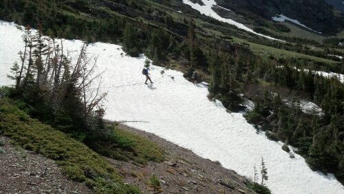
First On-trail Post – June 21, 2013
Greetings from Saint Mary, Montana. Enjoying an unplanned visit to a town at the edge of Glacier National Park. We have now hiked for three days and covered fifty miles. The first 1 and 3/4 days were blissful – amazing scenery, perfect weather. A 3,000 foot climb up Red Gap Pass on day 2 was challenging, but the views from the top were superb. With two hours or so remaining to hike on day two though we encountered a torrential downpour and scary thunder and lightning. Luckily we were down in the trees during the storm, and not up on the pass. We were supposed to camp at the Many Glacier campground that night, but our drenched group decided to go in on a room at the Swiftcurrent Lodge there.
The next day (yesterday), we were supposed to hike up and over Piegan Pass. This pass is higher elevation than Red Gap, and rangers informed us that we would hike over 100% snow cover for about eight miles. We felt confident about our ability to safely traverse the pass because we all have ice axes and microspikes, and several of us have gps units (in addition to maps and compasses). However, yesterday’s forecast called for more thunderstorms. After MUCH discussion, we decided to road walk around the pass. That meant a twenty-one mile road walk. Our decision turned out to be for the best. We met a group of four hikers who did attempt the pass yesterday, only to be turned back by the weather. It rained on us pretty much all day. For the most part it was no big deal until the last hour or so. The rain picked up in intensity, the wind got insane, and it began to hail. I was hiking in shorts, and the hail really was quite painful on my legs and head. We were all totally drenched and miserable. There is just no breathable rain jacket that can keep you dry in an all day downpour. I was freezing and on the verge of an emotional breakdown (not good for day 3 of the hike). Since we had the opportunity at the Saint Mary Lodge, we all went in for a hotel room again. Matt is joking with everybody about what a luxurious life thru hiking appears to be with us staying in hotels for two of the first three nights. Obviously, once we get out of the park, we won’t have these opportunities, so we might as well take advantage of these luxuries while we can. Nothing can restore morale better than a hot shower, a restaurant meal and a warm hotel room.
We zeroed (didn’t hike at all) today, and moved our stuff over to the campground. Lots of hikers are around, which is a rarity for the CDT. A group that was ahead of us got turned around by the weather yesterday and is here, as is the group that turned back before Piegan Pass. We will head out tomorrow, shooting for a 19 mile day. There are some major river fords coming up, and if the crossings seem too dangerous, we will turn back. The rivers are all raging because of all the rain, plus the seasonal snow melt. If our schedule goes as planned we will reach East Glacier via trail on Monday. If we have to turn back, it will be a thirty-one mile road walk to East Glacier. Certainly, we would rather take the trail, but the important thing is maintaining a continuous footpath from Canada to Mexico – some road walking is inevitable, but we will not consider skipping any sections (unless there is some sort of crazy circumstance that I can’t currently foresee).
The zero today has been great – there is delicious pie at the cafe less than a mile from our campsite. Also, we did two consecutive twenty mile days, which is a lot for the beginning of the trail, so everyone is hurting a bit. Hopefully we’ll all feel healthy and will have a good hiking day tomorrow. There is a chance of snow showers, but the weather should be better by Saturday.
Matt and I just finished two weeks of traveling in California. We stayed with my sister in San Francisco, his sister in LA, my friend, Tiny Mary in San Diego, and camped in Big Sur. We walked a ton throughout the trip, and I feel like I am in better shape for the hike now than before we left. We visited about fourteen different beaches and ate tacos on seven different occasions.
This life of luxury is about to come to an end. This evening we fly to Spokane, Washington, where my Mom’s cousins, Gary and Candi Bussiere are kindly hosting Matt and me, and my friends Barrell Roll and Moosie. Tomorrow we’ll scoop BigFoot up from the Spokane airport, and drive a rental car to Montana. We’ll camp near Kallispell tomorrow night and meet up with Steiner and Gangles. Sunday we’ll arrive in Glacier National Park, reunite with Grinder and hope to begin hiking Southbound on the CDT on Monday.
For the uninitiated, the CDT stands for Continental Divide Trail, a trail that runs some 2700 miles from Canada to Mexico through the Rocky Mountains. The people with the wacky names are friends of mine that I met during my 2010 Pacific Crest Trail hike. As a group, they (we) are known as the sobohobos. Somehow the stars have aligned, and we all find ourselves headed for the trail life again. I am beyond grateful to have the opportunity to hike with this group again.
